Showing mum a little bit of Australia
A 3 week road trip across the beautiful, vast Aussie landscapes, in the form of an unreasonably long blog post

Yes, this road is an outlier. It’s not a 4WD after all. (access to the Breakaways near Coober Pedy)
Poland happens to be located… some distance away from Australia. This makes spending time with mum difficult and infrequent. As such, I figured I’d try to get her her time’s — and money’s — worth and get the hell out of Sydney for as long as we manage.
The Prep
I’m quite fortunate in that my company allows taking a sabbatical once achieving a certain tenure. The longer the tenure the longer (or better compensated) the sabbatical - but as a person who enjoys time off and a good work-life balance, I decided to jump on it as soon as I could, i.e. after 3 years. This allowed me to take a month off outside of my normal PTO.
A month off typically needs to be arranged with some advance — as was also true in this case. Mum runs her own company, which on the one hand gives her more freedom, but on the other means she works considerably more than a normal full time job, so she also needs advance notice to catch up as much as she can and aim for times of the year that are somewhat less busy. We also wanted to score a relatively cheap flight — so we did our very first bits of planning back in April, 5 months ahead of the anticipated dates.
We — and by we, I mean I, as I was in charge of the route — decided to go on a road trip. The longest one either of us have done by far.

A much more common sight. (somewhere between Coober Pedy and the SA/NT border)
A road trip allows a lot of flexibility in choosing what to see and when to get there. I also personally simply love driving… as long as I don’t see any cars in front of me. The Outback is a perfect destination.
The upside downside, of course, is the long driving times. Also spending a metric bucketload of money on fuel.
All that said, there’s a big question — do I use my own car, or do I rent? WIth the follow-up — if renting, do I go for a small car or a camper van?
We even considered splitting the difference and renting a car for a part of the trip, then returning it at a different location and doing a campervan relocation if it saves us some money, but we couldn’t find any relocations that would work — and returning a car at a different location comes at a premium. In fact, the cost of renting basically any car for 3 weeks is terrifying — and many rental companies have limitations on where the car can be taken, most notably forbidding entry into NT, which was one of our must-haves. We also decided a 3 week trip in a camper van — having never done a trip in a camper van before — might be going in a touch too deep.
Ultimately, I decided to drive my own car.
My car is fun to drive.

Not the biggest roadkill by far. (somewhere between Denilinquin and Balranald)
Knowing that we’ll be driving a small hatchback — that claims to be AWD, but I wouldn’t want to try to push it too hard on gravel — we could get started on planning the route.
We knew we’d mostly be taking paved roads that have traffic — during the day — on the order of at the very least a car every 10 minutes, so we didn’t really need to do any extensive physical preparations. We just made it a point to bring a portable cooler and to ensure being over-prepared in terms of water for the desert — trying to have 2 days water per person — and otherwise decided to rely on the help of strangers if the need would arise. Aussies, especially in the Outback, tend to be friendly and helpful. We had people stopping to ask us if we need help when we simply stopped for pictures.

Am I going overboard with the long straight road pictures? No, surely not. (somewhere between Charters Towers and Emerald)
The Route
I started with several destinations I considered must-haves, then built a route around them. Outside of the desert — where the number of available beds is low, so I wanted to ensure booking them ahead of time — we mostly winged it, only making sure we have the next one or two nights booked. We would typically decide on what we want to see next on the eve of seeing it.
The must-haves were as follows, in order:
Bright, VIC — as I’m considering moving there at some point
Broken Hill, NSW — for the best milk shakes I’ve ever had
Uluru, NT — I’ve lived in Australia for nigh on 6 years and I still hadn’t seen this giant pebble
Cairns, QLD — wanted to see some tropical Australia and Darwin was a touch too far to include
Grafton, NSW - we timed the trip with the Jacaranda Festival, can’t skip Grafton at the end of October
Tamworth, NSW - for the best burgers I’ve ever had

Beef patty, buttermilk chicken, slow cooked brisket and bacon. The burger to end all burgers. (Williamsburg, Tamworth)
The rest followed from there, with nights spent at the following locations:
Bright, VIC
Mildura, VIC
Wirrabara, SA
Coober Pedy, SA
Ghan, NT
Petermann, NT
Alice Springs, NT
Tennant Creek, NT
Mount Isa, QLD
Torrens Creek, QLD
Cairns, QLD
Paluma, QLD
Emerald, QLD
Noosa, QLD
Maclean, NSW
Tamworth, NSW
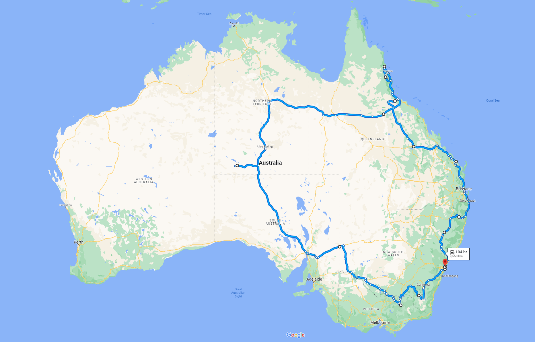
The approximate route. Google Maps won’t let me input enough intermediate points.
What we originally estimated to be upwards of 9000 km, ended up being exactly 11601 km over 22 days for an average of 527 km a day. Or an approximate 1.1 cubic metres of fuel in total.
The Trip
Day 0: Mum arrives in Sydney
This in itself isn’t worth mentioning, as this is what this whole post is about. The only thing of note here is that she arrived a day later than anticipated… because she misread her ticket. We were planning to give her a day off to get closer to Aussie time. As a result, she’ll be quite jetlagged for the next day or two.
Day 1: Sydney to Bright via Canberra and Cooma
Originally planned to go through Cooma, then all the way south to the shore, then back north via the Great Alpine Road. The plan was foiled due to running behind schedule as well as mum struggling to stay awake. I’ve seen all the views here, so once we got to Cooma we decided to cut it a bit short and head up north to Tumut, follow the motorway to Albury and get to Bright, ideally while it’s still bright (hehe).

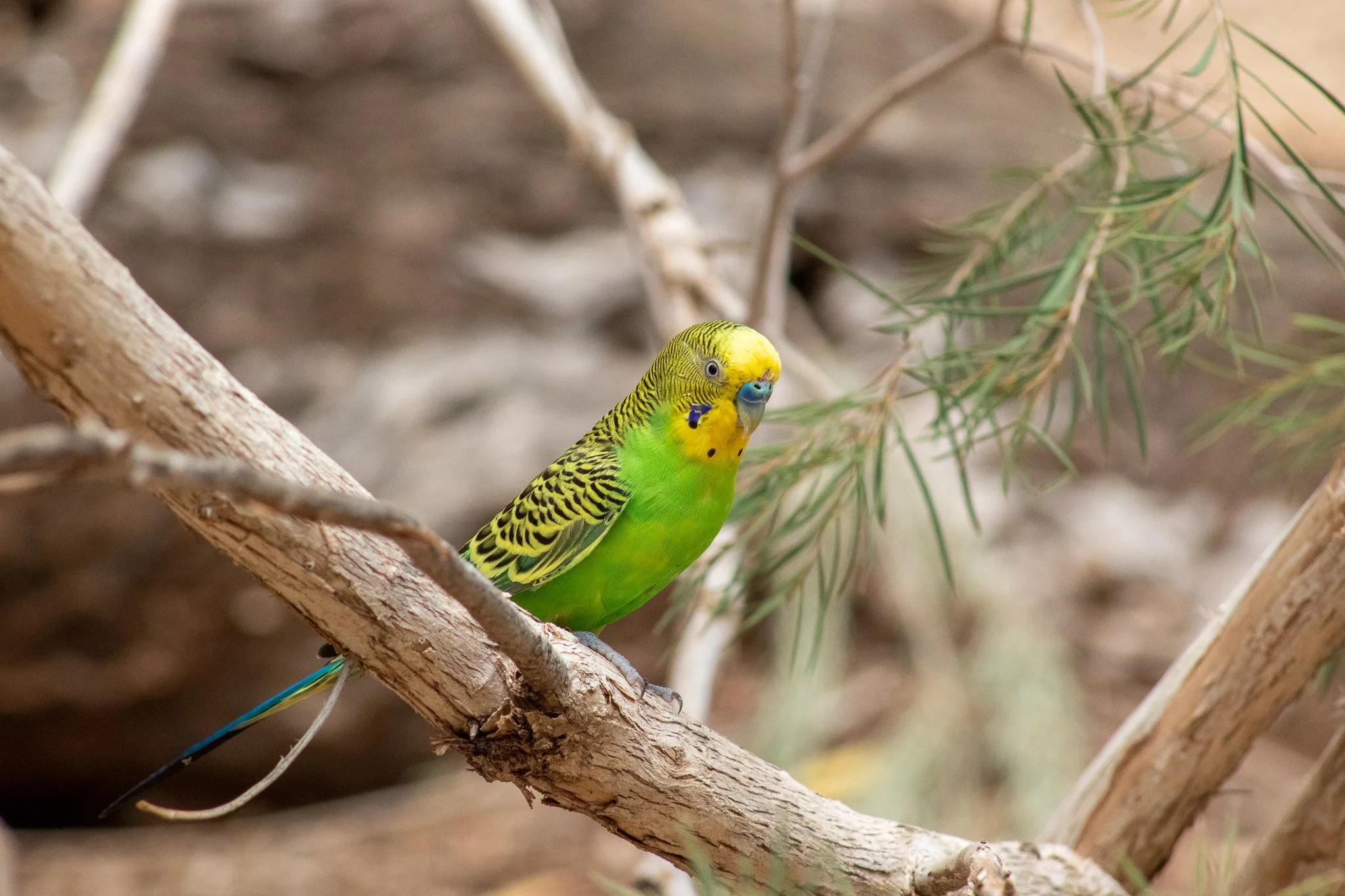
Scruffy-looking rainbow lorikeet (Canberra Walk In Aviary)
We did stop in Canberra, though, for a meal and to visit the local walk-in aviary. Canberra, as always, didn’t fail to deliver that distinct ‘ghost city’ vibe. It’s hard to believe almost 400,000 people call it home. The aviary was the first of several we visited on the trip — yes, dear reader, I will bore you with more bird pictures — and it definitely was a nice way to break up the long drive. Birds were plentiful, their colours lively, and we got to see a cockatiel try to bang a pigeon.

Go get her, buddy. Excuse the low quality. (Canberra Walk In Aviary)
Day 2: Bright
We spent a total of 3 nights — or two days — in Bright. Like I mentioned, it’s a place I’m considering moving to somewhere down the line. After these 3 days, I’m even more convinced I should do this. The town is beautiful. One distinct memory is walking out of Woolies at 9 pm and not hearing a sound, while the air was filled with the smell of flowers. I’ve also seen Bright in autumn though, and it’s just as lovely, with all the colourful leaves. The people seem super nice — though this is only based on several conversations so far. Lovely place.

The pine cones are a menace, though. (Bright)
The first day in Bright was dedicated to having a look around the town — the market streets, a walk along the river, trying the burger place. The burgers were decent, but it’s no Williamsburg.
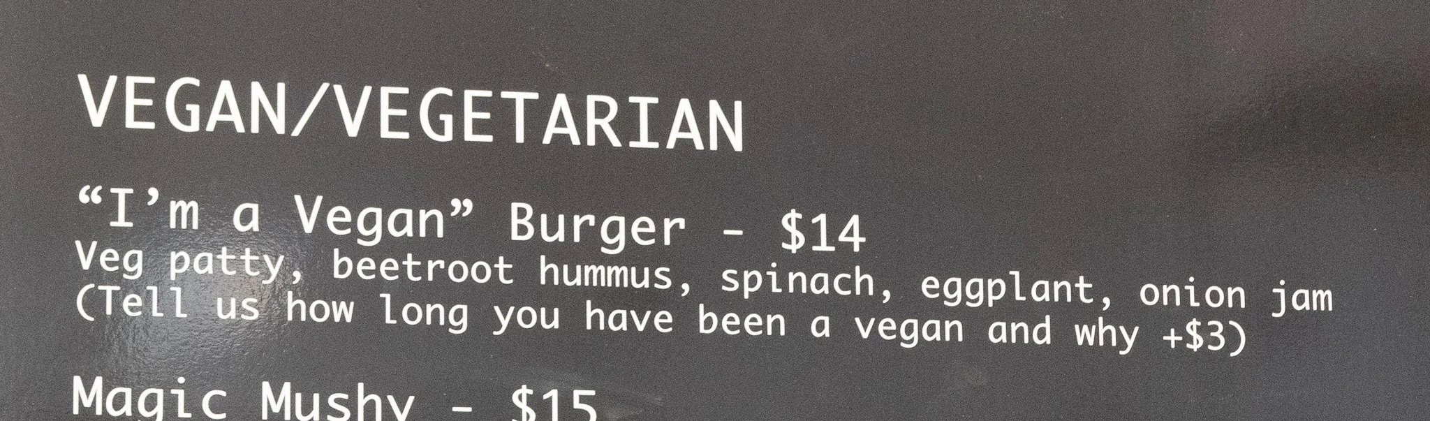
They have the right idea about vegans. (Burgerville, Bright)
The river walk was lovely. The first section led through a nice, well maintained — if a bit small — park…

Mum in the park (Bright)
… and then it got more bushy — I could absolutely see myself doing this walk often. And we got to hear and see blackbirds. Their song is beautiful and they’re very hard to find in Australia — I’ve only seen them twice in close to 6 years.

Bridge over the river (Bright)
Day 3: Bright surroundings
While in the area, we decided to check out a few things that I’ve driven past before but for one reason or another never at the right time to actually see them.
One of them was a deer and emu farm. For a few bucks we got to feed the animals from buckets. Turns out emus are aggressive eaters. Their call is also insanely low - you feel it more than you hear it. As we found out, their hearing range also covers very low frequencies — they listen for distant thunderstorms and follow the sound in hope of finding water.

Still not as aggressive as me with pizza. (The Red Stag Deer and Emu Farm, Eurobin)
Another stop we did was finally visiting The Horn in Mount Buffalo NP. I’ve been there before, but at that time decided against getting on the gravel section (last 3 km or so of the road). Big mistake. The road is narrow and steep, but decently maintained. The view — 360 degrees of beauty.
Pied currawong with the best view. (The Horn lookout, Mount Buffalo NP)
We stopped at Sir Loin’s in Bright for an early dinner, where I had the best steak I’ve had so far. Wagyu, MS 7+. Delicious and way too expensive. No pictures (and to be fair, it looked like a steak).

Yours truly. (still the Horn lookout, Mount Buffalo NP)
It was also the first time I’ve been to the Aussie Alps around the snow season. Well, on the weekend immediately following the end of the snow season. There was still a decent amount of snow lying around, if not very fresh.
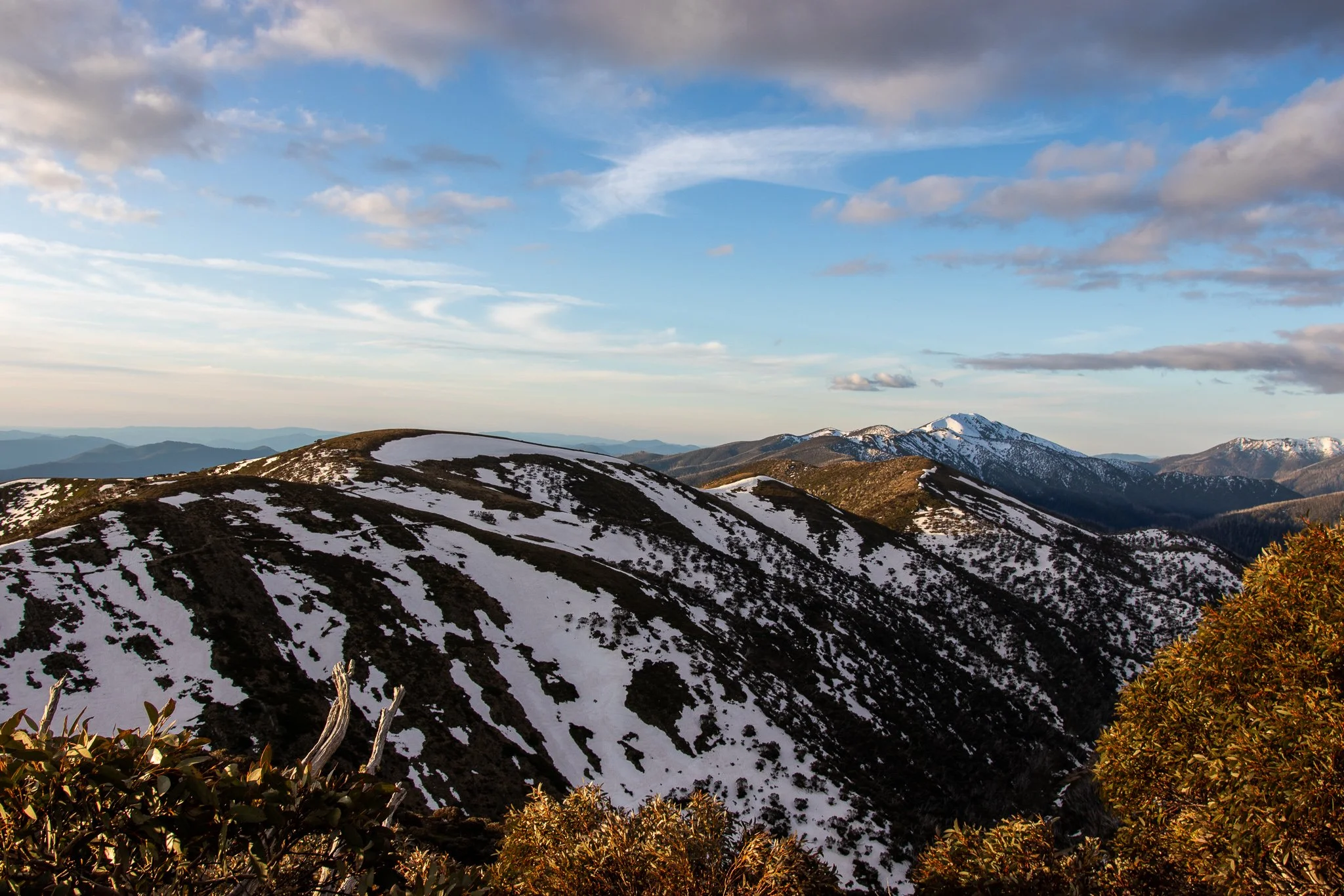
The last of the snow. (somewhere between Smoko and Mount Hotham)
We stayed in the mountains until the sunset, and headed to Bright Brewery for some locally crafted beers to top the night off.

A road sign. (somewhere between Smoko and Mount Hotham)

One more sunset pic for good measure. (somewhere between Smoko and Mount Hotham)
Day 4: Bright to Mildura
Day 4 was mostly a transit day. Both mum and I have been to Mildura previously, so we didn’t re-explore the same areas again. We mainly used Mildura as a place to stop for the night before continuing on. We followed side roads on the NSW side of the Murray.

And there was some flooding near the road.
The drive was mostly uneventful. Mostly.
Imagine an empty road, no crossroads for tens of kilometres, and suddenly there is one — and we actually intend to turn! Mum was driving — the experienced driver that she is, with over 20 years under her belt — and this one corner in the middle of nowhere was probably the most dangerous situation of the whole trip. She slowed down way too late, forgot to downshift, and we ended up stopping dead in the middle of the crossroads, pointed exactly between the road straight ahead and the one we intended to take, engine off, mum in visible confusion and slight panic. Thankfully, traffic was very low. In mum’s defense, she hadn’t driven stick in a few years and traffic in Poland is right hand side. Didn’t stop me from giving her crap about it for the rest of the trip.

This could have been us. (bit anachronistic — we didn’t see this until the next day — in Silverton)
Day 5: Mildura to Wirrabara via Broken Hill
Broken Hill remains one of my favourite small NSW towns. Home to about 17500 people, it’s a mining town in the middle of nowhere, with the nearest significant establishment around 300 km away — Mildura, that is. Broken Hill has one of the biggest deposits of lead and zinc in Australia as well as some silver. The local Aboriginals have a story for where the deposits came from. Supposedly, long ago, one of the Aboriginals was hunting bronzewing pigeons. One managed to escape, but it was wounded. As it fled, it was stopping to rest and the blood and feathers it was losing was forming the minerals. Its spirit supposedly went all the way to Mount Isa, which will also be a stop on this trip. I’m not sure if geologists would agree, but I like the story.
Between railroad museums — Broken Hill first had a connection to South Australia rather than NSW and still belongs to the SA timezone, mineral museums and the best damn milk shakes I’ve had, there’s plenty to do in Broken Hill, but the area around it is also stunning.

Hehe. (Albert Kersten Mining and Minerals Museum, Broken Hill)
I remember marvelling at the vast wastelands around Broken Hill during one of my previous visits, when I rented a 4WD and went off the beaten track. Certainly the most desolate areas of NSW — the area north of Broken Hill is “Unincorporated Regional NSW” for a reason. On the route I picked I had to cross 18 cattle gates. Love it.

Not actually from this trip. Sue me. (the desert north of Broken Hill, April 2022)
There’s also the tiny town of Silverton nearby, with its old ruined buildings and a historic graveyard. Silverton has a Mad Max museum, as one of the movies was filmed in the area. I’ve been to this museum and mum doesn’t have much interest in Mad Max, so we skipped it this time.

They also have this thing, parked outside the pub. (Silverton)
Silverton is also right at the doorstep of the Mundi Mundi plains. I’ve been to the Mundi Mundi lookout about 4 times now and it never disappoints. The plains are vast. Hard to imagine until you’ve seen them. Pictures don’t do them justice. At least mine.
The desert is much greener than it used to be, presumably thanks to the third consecutive La Niña year, so it doesn’t look quite as empty, but I’m sure it will revert to it’s normal reds dominating over the greens soon enough.

Parts of the desert are positively blooming. (somewhere between Broken Hill and Silverton)
After a longer stop at Broken Hill, we headed to Taralee Orchards in Wirrabara for the night. The very end of that trip was quite tense — because of about ten kilometres of poor quality gravel road, in the rain and darkness — but the stay was lovely. We had a two bedroom cabin to ourselves, with a fireplace and wood provided with no extra charge. Definitely one of the better nights of the trip.

And this was our view in the morning. (Taralee Orchards, Wirrabara)
Day 6: Wirrabara to Coober Pedy
Most of this day - and frankly most of the drive the next few days - was just transiting. There really isn’t much in the desert between the infrequent roadhoases and even rarer actual settlements. Which doesn’t mean we haven’t seen a few nice views along the way.

Pretty rocks. (Germein Gorge)
Germain Gorge leads to Port Germain, home to the once upon a time longest wooden jetty in the Southern Hemisphere.

The jetty is indeed quite lengthy. (Port Germain jetty)
We stopped at Port Augusta to restock. This was the first location where we saw significant numbers of Aboriginal people. The theme, unfortunately, is poverty, ranging between homes looking like homeless camps and districts looking poor but well kept. I would love to have a conversation with some of the locals about what life is like and what their problems are. I didn’t have much of an opportunity, because I’m not really one to approach a random person in the street and ask about their life story and struggles. One day perhaps.
Port Augusta is also of note because it marks the spot where reasonably frequent 4G reception ended. Vodafone coverage in rural and Outback Australia is virtually nonexistent — Telstra is better, but I’m pretty sure it’s still only available in towns. For almost the next 4000 km, there were 2 spots with reception - Yulara and Mount Isa. The area is wonderfully empty and you can go 500 km around the speed limit and only need to overtake — or be overtaken — once or twice. Beautiful.

Empty. (somewhere on the Stuart Highway)
It also marks the start of proper road train country. In fact, on the Stuart Highway — the stretch of road between Port Augusta and Darwin, some 2700 km with really not much along the way — it’s mostly road trains with the occasional camper.

It’s mostly this. Or the one with 4 shorter trailers. (somewhere on the Stuart Highway)
The road between Port Augusta and Coober Pedy doesn’t have many things worth stopping for, but one of those is definitely Lake Hart. When I went there back in April, it was literally just salt — this time around there was a little bit of water.

But there was also salt. (Lake Hart)
It’s quite a big lake, too. From a distance, it’s really hard to be sure whether there’s water in it or only salt.

Frankly, I think it looks better without the water. (Lake Hart)
We drove through the area in the spring and soon after rains, so plenty of desert flowers were in bloom, but we only spotted one place that actually had wild Sturt desert peas.

Weird looking flowers. (Sturt desert peas, somewhere along the Stuart Highway)
Three types of flowers stood out — I’m unsure of the names of the latter two though.

There were oceans of these along the highway. (somewhere along Stuart Highway)
Once we got to Coober Pedy — and found out there is no 4G — we checked in to a dugout B&B. We managed to do some further trip planning at a restaurant which offered WiFi access.

Not quite as many of these, but we did find a field full of them. (somewhere along Stuart Highway)
Coober Pedy inhabitants got the idea of living in dugouts because the temperature outside in the summer was just unbearable — frequently exceeding 40 degrees. They figured that since they’re digging anyways, they might as well sleep in the mines. Nowadays about half of Coober Pedy’s population lives undeground. The night in the dugout was definitely one of the coolest nights of the trip.

With this view right out front. (Coober Pedy outskirts)
Day 7: Coober Pedy to Ghan
We started the day by exploring Coober Pedy a little. The tiny town’s main draw — and main export — are their opals. The whole area is like Swiss cheese — there are signs that inform you that you shouldn’t run or walk backwards in the mining fields, because there are tens of thousands of holes — wide enough for a human to fall into and approx. 20 metres deep. Anyone can get a license and a claim — and they cost pennies, as do Coober Pedy properties — and start digging. With a lot of luck, you could make millions in a day. Without it, you could waste years and find nothing.

At approx. 2500 people, “city” is a bit much. (Coober Pedy)
I think it takes a certain degree of madness to choose this lifestyle — but they make it work. Coober Pedy produces about 80% of Australia’s opal and Australia produces about 90% of the world’s. Within the town limits, there are piles of discarded rock and gravel from old mining operations — as a tourist, you can try your hand at finding some opals in them. I doubt there’s anything of actual value, but I did find several small pieces of opal and some of them even had a bit of fire. But unless you’re an opal mining nerd, the town doesn’t have much to offer. The name of the town is thought to originate from the Aboriginal term for “white man in a hole” (referring to the dugouts) — this area is so arid it wasn’t populated until the colonists arrived. It’s mostly dust and dirt.

Hundreds of kilometres of dust and dirt. (the Breakaways near Coober Pedy)
Coober Pedy has an awesome, somewhat postapocalyptic aesthetic. Apart from the iconic dugouts, there’s plenty of corrugated metal sheets, rusty vehicles, abandoned — and still in use — mining machinery and in general all sorts of mechanical garbage. One might think it’s function over form, except it’s really not. If I were to make up a term, I’d call it rustcore or garbagepunk.

I didn’t take enough pictures this time. This one’s back from April 2022. (I think it was at Crocodile Harry’s, Coober Pedy)
And they don’t take themselves too seriously.

Definitely at Crocodile Harry’s. (Coober Pedy)
Themselves or their cars.

Parked out front of the servo. (Coober Pedy)
Having given Coober Pedy a closer look, we headed off towards the Northern Territory for our next night — in the Erldunda Roadhouse in Ghan. This moment marked the point in the trip when we were getting into areas I haven’t seen before. Naturally, now that I was about to enter NT, I had to get me a CU in the NT hoodie.

It say's ‘STRAYA / CU in the NT’ on the back. (SA/NT border)
Day 8: Ghan to Petermann (via Uluru)
Due to accomodation limitations, both the night before we saw Uluru and the night after were spent approx. 250 km from Uluru itself. Not exactly a short commute — though not that long either by Outback standards. We had to get up pretty early if we wanted to do the Uluru walkabout and top it off with a helicopter flight to see it from up above.

One of several birds that commited suicide by car on this trip. This one was a galah. (somewhere between Ghan and Yulara)
On the drive to Uluru, we saw a mountain in the distance and at first we actually thought this might be it, but then we saw that we’re still about 150 km away, so it didn’t check out. Turns out it was Mount Conner.

Fake Uluru. (Mount Conner)
We started our walk around Uluru a little late — around 10 am — and as a result, by the end, it was getting quite hot. Both mum and I underestimated the amount of water we will need. We finished the walk and we made it safe back to the car, but I did get a dehydration headache and the last 2 or 3 km weren’t much fun.

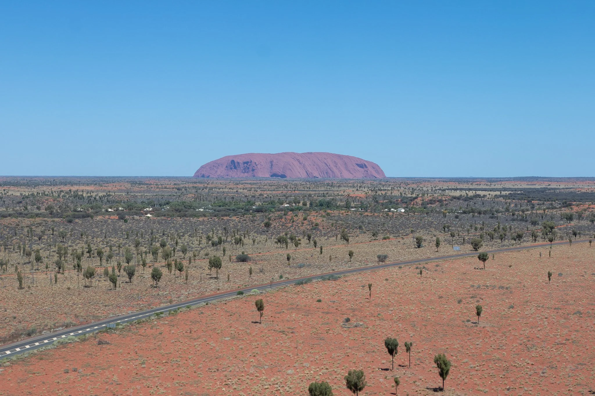
The big pebble. (Uluru)
The monolith itself is stunning and it’s easy to see why it would become a holy site for the locals. It’s a lone, single giant piece of rock, with not much geology for tens of kilometres around it. It’s nooks allow for some water to pool and the erosion looks amazing.

Eroded bits. (Uluru)
The walk around it is easy — except for the temperature — no climbing involved and the ten kilometre loop is easy to follow. It’s hard to take a good picture of it up close, though, as it just doesn’t fit.
So we took to the skies.
I lucked into getting the front seat to this. (Uluru)

Seeing it from above makes you appreciate the scale (Uluru)
It was the first time either of us flew in a helicopter, so the flight itself was an adventure as well. I already knew I struggle with motion sickness on ultralight airplanes, now I know helicopters aren’t easier. The dehydration from the walk wasn’t helping my stomach either. Thankfully it was just a 15 minute flight, so I managed to hold it together, and the experience was definitely worth the discomfort.

I’m out of captions. (Uluru)
Having seen Uluru, we stopped at Yulara to refuel and were greeted by a surprise — there were locks on the fuel pumps. This was not the last time we were going to see local servos taking preventative measures against fuel theft. Speaking of, the fuel prices in the desert have about a 40% markup over the ones in the city.

Foreshadowing the canyon from the next paragraph. (somewhere along Luritja Road)
Following that, we headed off towards Kings Creek Station in Petermann which turned out to be another great night. We met a Polish couple — who also live in Sydney — and enjoyed a conversation over some scotch, while a thunderstorm raged over the canyon in the distance and gentle rain tapped on the tin roof of the kitchen area.

Some places are more deserty than others. (somewhere along Lasseter Highway)
After an enjoyable evening, we slept in a bush tent — a solid built tent with AC, but with just enough room for two single beds. I didn’t sleep very well, but I felt extremely cosy, listening to the strong winds whistle against the tent all the way through the night, with a large flock of galahs serving as our alarm clocks.
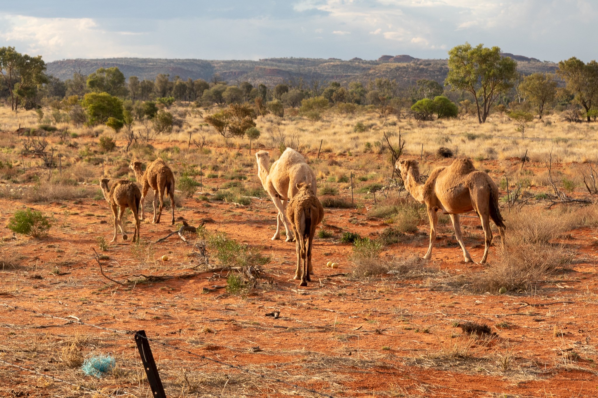
The station was also a camel farm. Mum had a camel burger. (Kings Creek Station)
Day 9: Petermann to Alice Springs
We started the next day by heading to Kings Canyon for a little walk. The scotch took its toll though and as a result I was hungover and we hit the road a bit later than planned, with mum behind the wheel. When we got to the canyon, we decided against doing the rim walk, as it would involve a climb at the beginning and is estimated for 3 to 4 hours. The hangover dehydration and 35 degree heat probably wouldn’t have killed me, but I would have had a horrible time. We opted for the short walk into the canyon instead.

This is the path up to the rim walk. (Kings Canyon)
The canyon has considerably more plant life than the surrounding desert and is quite picturesque, with the green shrubs and trees contrasting with the red desert rocks.

View into the canyon from the path. (Kings Canyon)
At the end of the canyon there is a viewing platform with metal figurines of several species of birds and Aboriginal descriptions or stories related to them.

In my infinite wisdom I did not take a picture of the plaque explaining who these guys are. (Kings Canyon)
We also spotted some spinifex pigeons, which I had known about from the internet before. Cute little guys — they prefer not too fly too much, choosing to run away or camouflage instead. When one of them was sitting on a rock I noticed that its brown colour is almost perfectly matched with the rock itself.

Two of these guys would in the following days commit suicide by crashing into our car. One of them took my license plate cover out with it. (Kings Canyon)
About the time we got back to the car my hangover had subsided, so I was fine to drive. The trip to Alice Springs was quite roundabout, as the two shorter roads are both gravel, the shorter of which has a 100 km gravel section. The longer also requires a permit.

Still, we got there, and so did Myrtle. (Alice Springs)
We didn’t stay in Alice Springs very long — only one night and half the next day — so my view of the town may be skewed. I found it to be in a weird contrast with itself. On the one hand, it looked quite poor. On the other, there was plenty of art on the buildings and it didn’t seem to be suffering from vandalism. The surroundings of Alice Springs are very pretty — it’s nestled between small desert mountains — and they have a botanic garden and a large desert park which we’ll get to tomorrow.

An example of the local art. (Alice Springs)
But meanwhile, we headed for our stay. It was a backpackers place — the cheapest stay of the whole trip — and as such it wasn’t of the highest quality. It did the job though, and we got given the keys to the Unicorn Room.

I can’t figure out why they named the room thus. (Alice’s Secret Travellers Inn)
Apart from the unicorn, we had this chick staring at us.

Crack whore pixie. (Alice’s Secret Travellers Inn)
Day 10: Alice Springs to Tennant Creek
Before heading off further, we decided to stop at the Alice Springs Desert Park and Simpson’s Gap. The desert park is lovely, but I think mostly interesting to bird people. There are several aviaries, including some walk-in ones, and they organise bird shows.

The wedge tail eagle approaches. (Alice Springs Desert Park)
The bird show was one of the better ones I’ve seen, showcasing mostly birds of prey, including kites, a barn owl, a black breasted buzzard and of course a wedgie. A self-tamed willy wagtail kind of stole the show though, flying around the handler and asking for treats.

And of course we opted to get pics with the birds afterwards (Alice Springs Desert Park)
We spent almost 4 hours in the park, exploring all the aviaries and trying to take pictures of the birds — more to follow later. But I did finally manage to get a decent picture of a wren. I’ve been occasionally trying to snap one around Sydney — though the wrens are different — but the cheeky buggers like to dwell in thick bushes, so it’s usually difficult to get a clear picture.

A splendid fairywren to be exact. (Alice Springs Desert Park)
Another point of interest in the park was their dingo enclosure, housing 2 purebred dingos, 8 or so years of age. I had never seen a dingo in person before and was always under the impression that they are dangerous. Turns out they’re good boys — curious but shy by nature. Unfortunately, very few purebred dingos remain — and some parts of Australia still consider them pests.

No way this good boy would eat anyone’s baby. (Alice Springs Desert Park)
Simpson’s gap, where we headed next, turned out to have a great return on investment in terms of effort it required and the view you get as a reward. Following a short walk from the parking lot, there is — at least at times — a small pond at the bottom of the gap in the mountain ranges, with very strong winds blowing through. Stunning place and very easy to see why Aboriginals consider it sacred. And one of those views that are hard to take a good picture of.
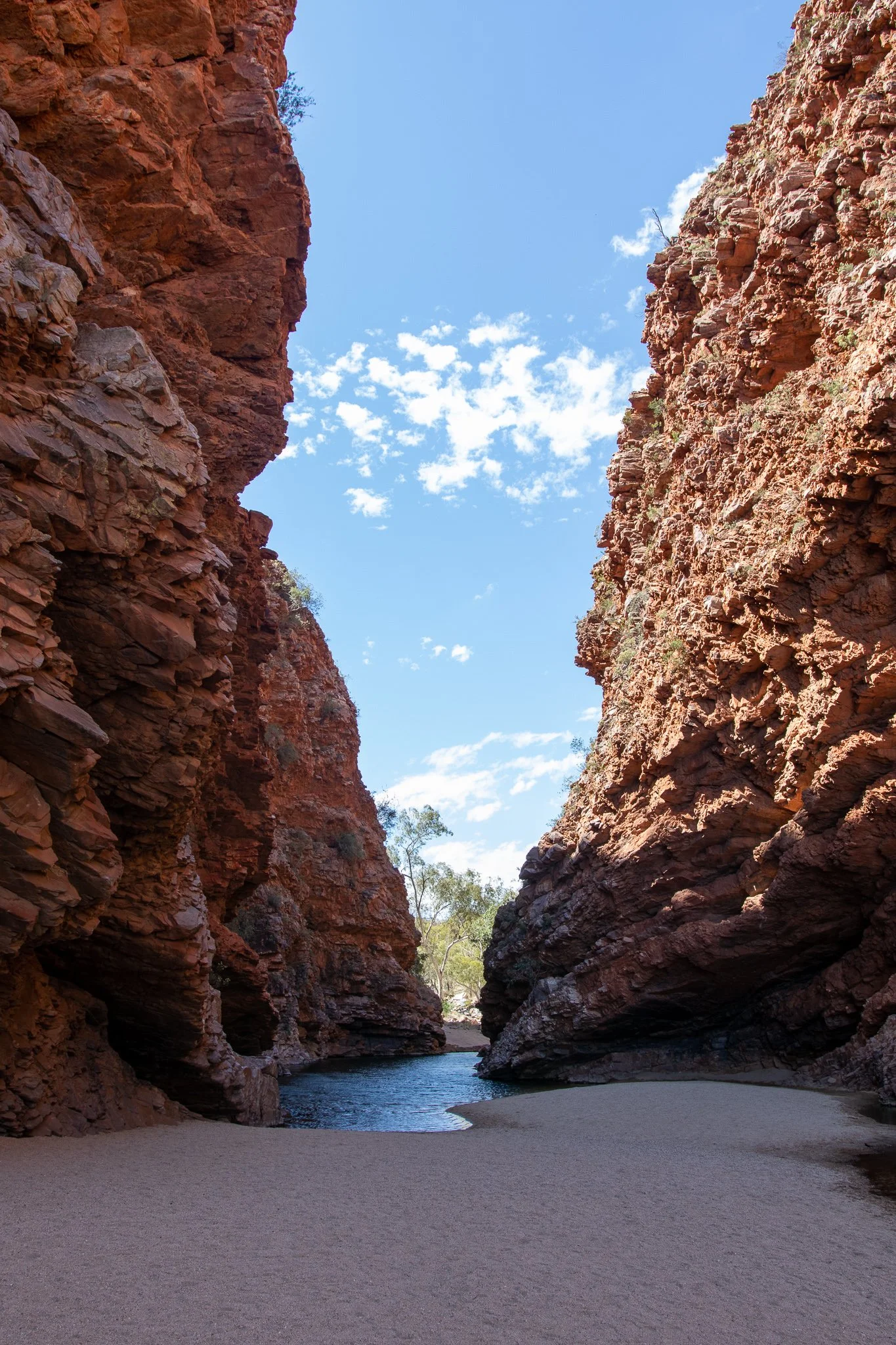
But not that hard to take a mediocre picture of. (Simpson’s Gap)
Following that we drove to Tennant Creek for our next stay. The trip was rather uneventful, though we did run into another fueling issue — the pump was set on prepaid while two Aboriginals were getting their own fuel — the servo eployees didn’t trust them to pay after refueling. I didn’t ask, but I can only hope they knew these specific 2 people rather than assuming that on the basis of ethnicity.
Day 11: Tennant Creek to Mount Isa
This was mostly a transfer day, not very eventful in itself.

Except for when a spinifex pigeon took out my license plate cover. (Barkly Highway, somewhere between Camooweal and Mount Isa)
Queensland Outback roads are definitely worse than most of the other roads on this trip. Any time the road crossed a tiny creek, you could expect a huge bump as the little bridge was either damaged or just not built right in the first place. A lot of the small bridges were also quite narrow — scary with a road train coming from the other direction — and there were parts where the shoulder was quite washed out.

It’s also a very empty area, but less of a desert and more of an endless plain (Barkly Highway, somewhere between Warumungu and Mount Isa)
One thing I didn’t take a picture of were the termite hills that littered the side of the road in many places. Quite thin and tall, there were tens of thousands of them along the road. Someone started a tradition of dressing them up in t-shirts and the like — ranging from worn out rags, through newer-looking shirts, all the way to hi-vis jackets and hats to match — and sure enough there were hundreds of dressed up termite hills along the way. Classic.

And in the absence of the termite hills, it was, again, very empty. (Barkly Highway, somewhere between Warumungu and Mount Isa)
Day 12: Mount Isa to Torrens Creek
Here we had to improvise a little. We were trying to get to Cairns in 2 days, but online booking options were rather limited, unless we were happy to split it into one day of 5 or so hours and one of 9. I ended up finding a little motel in Torrens Creek, close to the midway point. I had to call directly — like a caveman — and was greeted by a proper Queenslander, ending every sentence with ‘mate’. Upon meeting him in person, we found out he’s lived in the area his whole life — town of 70. The stay was decent enough, the pub feed surprisingly good and the internet non-existent.

And the road there leads through, surprise, more vast empty plains. (Flinders Highway, some distance west of Hughenden)
But I’m getting ahead of myself. Mount Isa itself is a reasonably sized town built around their mine — copper, lead, zinc and silver — and the refining industry that follows it. They refine the copper to 99.7% purity before shipping it off to Townsville for further processing. The smelter stacks look quite impressive as they tower over some of the main streets of the town.

They also have a lookout whence you can admire the industry in full. (Mt Isa Lookout)
Generally speaking, birds and mining have been the themes of the trip. So after a quick detour to lake Moondarra — in search of birds, of course, though we found a kangaroo and some lizards instead — we headed east. The road between Mount Isa and Cloncurry is quite picturesque, though we didn’t stop to take any pictures. Either way, onwards, to the abandoned uranium mining town of Mary Kathleen!

What remains of the town. (Mary Kathleen)
The town was abandoned in the early 80s, so what remains is some asphalt and leftover foundations. The land has been rehabilitated and is currently a privately owned farm — with access to the mine allowed, as well as camping. There were some cows wandering around and we even managed to get one of the calves some head pats.

It seemed mostly indifferent. (Mary Kathleen)
Since the town turned out to be just asphalt and foundations, we soon left in search of the actual uranium mine. It turned out to be about 7 kilometres of very poor roads — mostly narrow dirt, with some Swiss cheese style asphalt mixed in. Along the way, we had a little adventure — we stopped to take a picture of a large lizard and the cheeky bugger escaped into the wheel well of my car and didn’t want to leave. I resorted to starting to roll very slowly to give it time to escape before it gets crushed. A few kilometres later, we reached a spot which we deemed unsafe to cross in my car and continued on foot for another kilometre and a half or so.
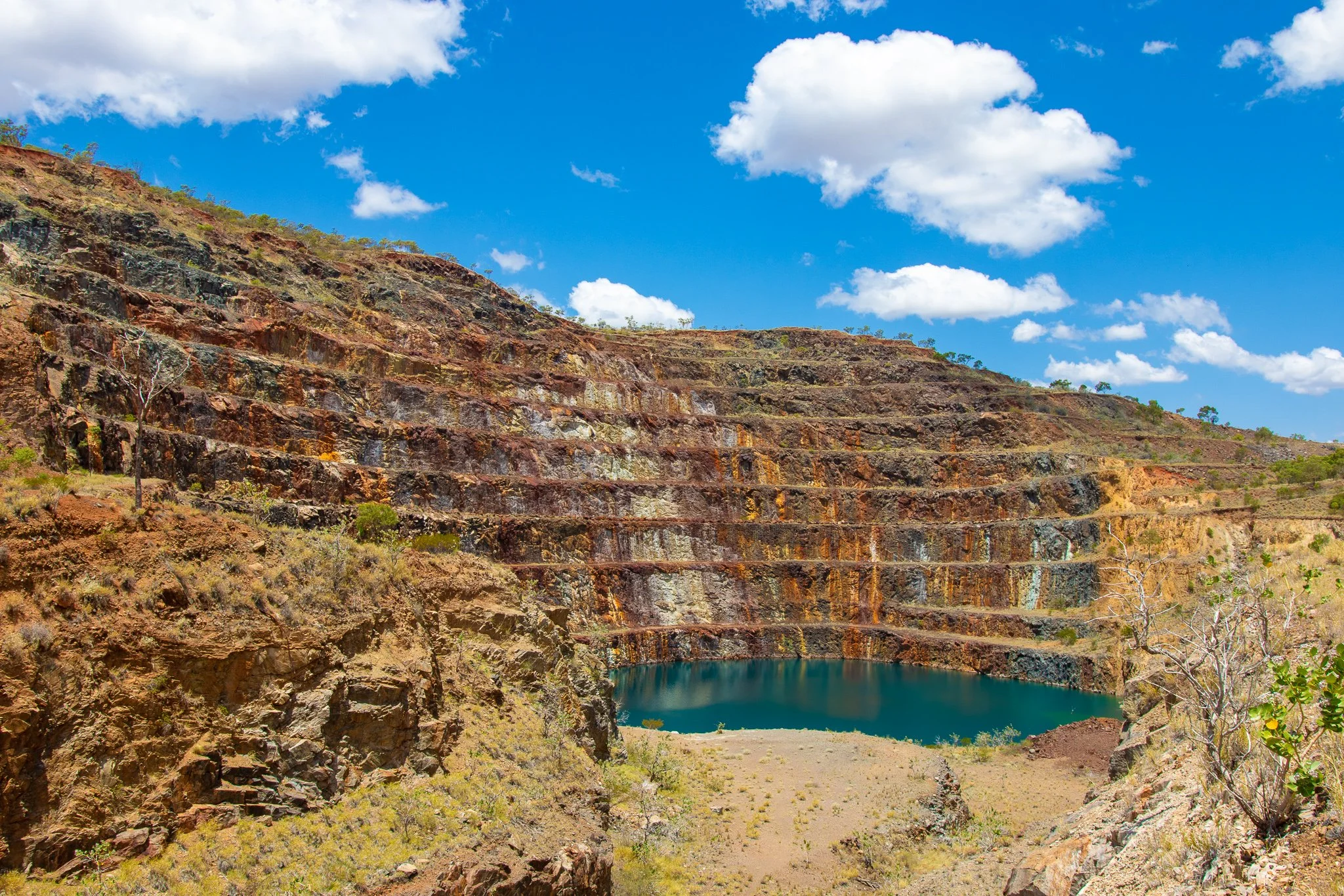
And we were rewarded with a view. (Mary Kathleen)
I’ve been to several lookouts overlooking open cut mines, but this one was the most impressive I’ve seen, especially since you can walk all the way down to the lake.

There are signs prohibiting swimming or drinking the water, though. (Mary Kathleen)
Since all the uranium has been mined out, the area rehabilitated and civilian access allowed, I reckon I should be safe in terms of radiation. If Chernobyl didn’t give me a third arm, I don’t think this will either. On the way, we bumped into a few camels, then continued on towards Torrens Creek.
Day 13: Torrens Creek to Cairns
Another one of those days that are mostly about getting to the destination.

And another road picture. (Somewhere between Torrens Creek and Townsville)
Two things that stood out this day was the extremely heavy rain — and drivers who can’t fathom turning on their tail lights when visibility drops to 30 metres — and how beautiful the area around Cairns is. The road itself goes through rather flat terrain, but it passes right by the tallest mountain in Queensland. The mountains gave me somewhat Hawaii-ish vibes.
Day 14: Kuranda
Kuranda is a village neighbouring Cairns. There are several ways of getting there — including a historical train and a cable car — but due to time constraints we decided to just drive. There were 3 locations we were interested in — Birdworld, Koala Gardens and Butterfly Sanctuary. Mum was most interested in Koala Gardens, myself, naturally, in Birdworld.

Mum has been craving Koala hugs for the whole trip. (Koala Gardens, Kuranda)
Now for anyone not in the know, koalas are actually bloody horrible beasts. Dumb as a bag of bricks, typically chlamydia ridden, and don’t get me started on how they gain the ability to digest eucalyptus. That being said, seeing a baby koala hug it’s mum was pretty damn cute, and their fur is softer than I expected (though nowhere near as soft as a baby alpaca — which I’ll get to in a few days).

Look at this little dude. (Koala Gardens, Kuranda)
Birdworld was great — heaps of parrots, small and large, some waterfowl and a cassowary. A lot of the parrots were very happy to interact with people — and a bag of bird food you can buy at the entrance definitely didn’t make them less keen, though the bigger ones tended to only allow hand feeding (except for eclectus parrots). The handlers told me that one of the macaws sometimes gets in the mood to land on a visitor, but that the other birds prefer not to get that personal.

A magnificent chicken. (Birdworld, Kuranda)

Big monch. (Birdworld, Kuranda)

One of Ivy’s kin. (Birdworld, Kuranda)

The eclectus and I shared a moment. (Birdworld, Kuranda)
Yup, this place was like Disneyland to me.

Even though the blue guy bit a mole on my neck hard enough to cause bleeding. (Birdworld, Kuranda)
The last spot was the Butterfly Sanctuary and — as we have been warned (thanks Bec!) — it was rather disappointing. The butterflies were beautiful and some of them giant, but there weren’t too many of them. I’ve definitely been to better ones before.

Still a pretty cool guy though. (Butterfly Sancturary, Kuranda)
Day 15: Daintree
While in Cairns, we decided we should also have a look at the famous Daintree Rainforest.
We started off by going on a crocodile cruise. We saw 4 crocodiles, including 3 fully grown ones and a tiny baby croc.

Big boi. (Daintree River)
The cruise on the river was relaxing and the plant life very lush, housing some cool birds that we managed to spot.

Azure kingfisher. (Daintree River)
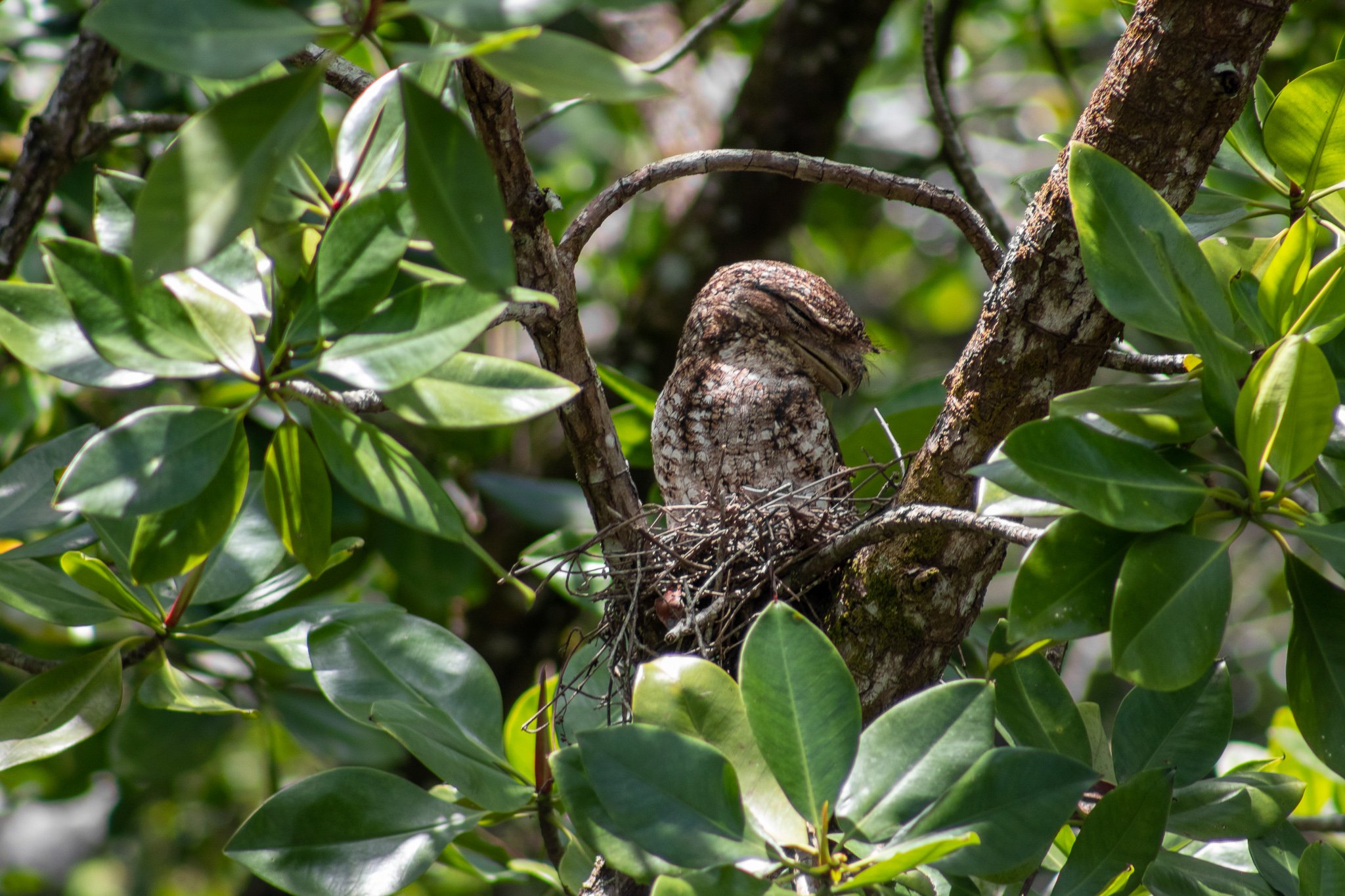
Nesting papuan frogmouth. (Daintree River)
After the cruise, we headed deeper into Daintree and here my thoughts are mixed. The forest is absolutely beautiful and amazingly lush — but you kinda get the feeling that everyone wants to fleece you.
First they make you pay 45 bucks for a return ferry ticket. 45 bucks! Being used to Wisemans Ferry near Sydney — which is free — I was shocked.
Next they make you pay 37 bucks per person for entry to the Discovery Centre. And it’s not even a guided tour — you just get a little ‘phone’ that you can press buttons on to listen to what they have to say. It’s beautiful, but I reckon twice as expensive as it should be.

I don’t even wanna think about who lives here. (Daintree Rainforest)

Mount Alexandra Lookout. (Daintree Rainforest)

I’m not quite sure if these count as mangroves. (Cape Tribulation)
Day 16: Cairns to Paluma
This is the first day that we markedly started heading back towards Sydney. With heavy hearts. But since the drive to Paluma isn’t too long, we took a detour through Atherton. The area around it turned out to be picturesque rolling hills. In Atherton, we stopped for a delicious brekkie in a lovely cafe, with seating in old converted rail cars adjoining the rail trail.

Atherton is also home to a large collection of minerals, arranged for display in an artificial cave. While the cave doesn’t exactly feel real, it does add some interesting flavour to the rock displays.

Like this sliced opal. (The Crystal Caves, Atherton)
It also has a particularly chonky amethyst cluster, though at the time of writing — 6 months later — I don’t remember how exceptional it actually is.

Taller than your average human. (The Crystal Caves, Atherton)

And so very purple. (The Crystal Caves, Atherton)
Further along the way, we did a quick stopover at Hinchinbrook Lookout before actually heading to Paluma. The last bits of the road were beautiful — narrow, winding mountain road, shrouded in mist. The stay in Paluma was also among the best, in a cabin in the woods, with a fire pit that the owners helped us start. The wood was moist and it took a few attempts, but the evening was lovely.

Another pretty sight. (Hinchinbrook Lookout)

A misty mountain road. (Near Paluma)
Day 17: Paluma to Emerald
Very much just a transit day. Hardly took any pictures. It didn’t come without a stressful bit though. We were running low on fuel — and actually took a 20-ish km detour in order to refuel with more of a margin of safety — and the roadhouse turned out to be closed that day. We panicked a little, as roadhouses in rural Queensland aren’t very common, but we decided to push on and just wait for help if we were to actually run out. We ended up making it to the next servo with about 4 litres left in the tank, which translates to about 40 km in the wrx. Cutting it way too close for comfort.
Day 18: Emerald to Bundaberg
Emerald and its surroundings are famous for their gemfields. We went fossicking for sapphires, just a few days after the rains had washed away the top layer of the soil and some lucky bugger found a sapphire worth over $12,000.
Ourselves? No luck. Couldn’t find a single one. We resorted to buying a bucket of dirt guaranteed to contain some sapphires, and even then we struggled to identify them and needed some help with it. I guess I won’t make a career out of fossicking.
The small chunks we found are likely worthless, although the local cafe / mineral store runner said one of them might be big enough to cut it.
Again, not many pictures from this day.
Day 19: Bundaberg to Noosa
Bundaberg is most renowned for its rum distillery. We took a tour of the place — I reckon it’s very much worth the money, considering that apart from an hour-long tour you also get 2 drinks of your choice from their selection of rums. I’m not much of a rum drinker, although one of the rums was pretty damn smooth.
The distillery doesn’t allow to bring in any electronics to avoid a fire, which they have had enough of in the past, so no pictures allowed. The whole place reeks of molasses and alcohol. The tour is interesting and the guides funny.
We also stopped at a strawberry farm to pick our own strawberries and were greeted by two very good boys. Strawberries themselves were delicious, though probably a bit overpriced.

Just look at them. (Unfortunately, I don’t remember which strawberry farm it was, Bundaberg)
Afterwards, we headed towards Noosa. Noosa is quite beautiful, although it turned out to be more of a tourist trap than we would like. It is located right next to Mount Tinbeerwah, though, which happens to have a lookout that is open around the clock — relatively unusual in Australia — and offers 360 degree views of the area. We arrived there around sunset, then departed for dinner in Noosa, then came back for some night photography. Mum was hesitant to climb to the lookout in the dark, but I managed to convince her and she loved it — thanked me for taking her there afterwards. No worries, mum!

I like sunset silhouettes. (Mount Tinbeerwah)

Hope the random couples don’t mind me taking these pics. (Mount Tinbeerwah)

Night sky at Noosa. (Mount Tinbeerwah)
Day 20: Noosa to Maclean
After a quick visit to one of the Noosa beaches, this was also very much a transit day. Unfortunately, we decided to go through Brisbane, which was a huge mistake. Traffic jams cost us 2 hours. We got to Maclean and basically went straight to bed.
Day 21: Maclean to Tamworth
Jacarandas, waterfalls and baby alpacas.
We started the day by visiting Grafton, which is famous for its Jacaranda Festival — and the festival was, naturally, the point. Around the beginning of November, the 1700 or so jacaranda trees are in full bloom and it is a sight to behold. A single tree can be the highlight of a view, with its ocean of purple flowers, but hundreds of them placed in a row put a giant smile on your face.

This is but a tiny part. (Grafton)
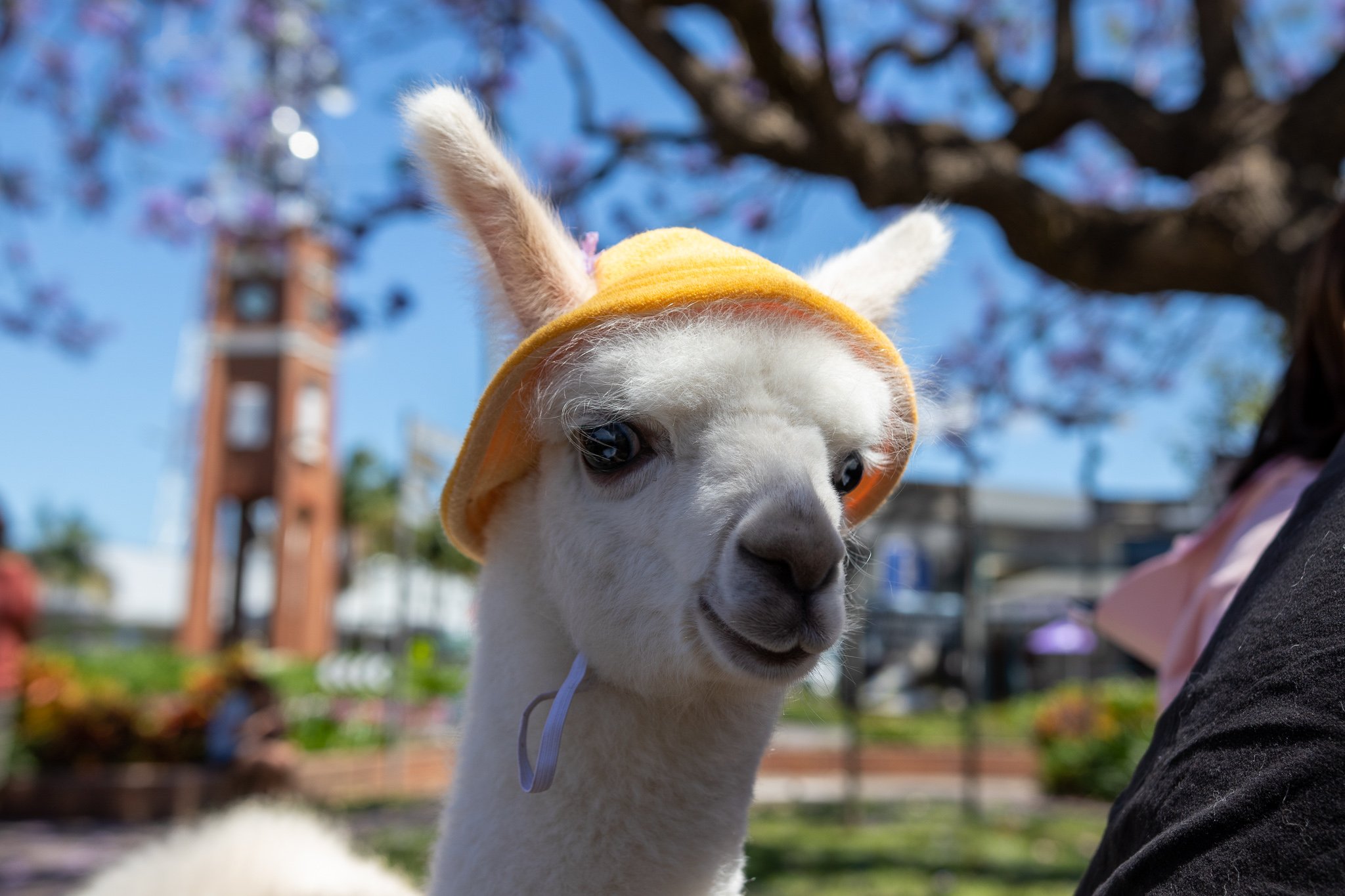
The festival attracts crowds, and crowds sometimes bring peculiar individuals. In this case, we ran into a family travelling with their baby alpaca. Yes. A two month old alpaca wearing a god damn hat. Won’t your heart just melt. You can’t even fathom the softness. You bet I’m gonna post 3 pictures of it in a row.

I mean, look at him. (Grafton)
The cutest thing you’ve seen all year. (Grafton)

He knows how cute he is. (Grafton)
Having left Grafton, we headed up Waterfall Way. It’s a road that runs directly past 2 relatively large waterfalls, with more waterfalls in the immediate area, and it ends at Dorrigo, which also has a waterfall. Since we travelled around the time of quite heavy rains — in fact, while in Queensland we were a little worried if northern NSW roads aren’t going to be blocked by flooding — the flow was heavy. We didn’t manage to take any good pictures of it, but there was a platypus playing in the pond at the bottom of the falls.

Dangar Falls. That tiny black dot to the left of where the water crashes into the pond? The platypus. (Dorrigo)
Headed for Tamworth, we took a quick detour near Walcha to see Apsley Falls. I’ve seen them thrice before, but this time the flow was the heaviest. The picture doesn’t really do them justice. It’s an absolutely amazing sight to behold.

This is the first of two stages of the falls. (Apsley Falls)
There are multiple lookouts — and a walk around — that help appreciate the size of the gorge. The picture below shows the depth of it after the water drops down the second stage of the falls. Normally water can’t be seen here, as it travels under the rocks, but the flow was heavy enough for some of it to show. Note how tiny the trees are.

The gorge. (Aspley Falls)
We stopped at Tamworth for the aforementioned burger and a night.
Day 22: Tamworth to Sydney
After having the burger again — this time for breakfast — we decided to stop by the botanic gardens.

Just some close ups. (Tamworth Botanic Gardens)

Just some close ups. (Tamworth Botanic Gardens)
The gardens are also right next to a little picnic area, as well as the local miniature railway. We got lucky and it happened to be a day when they actually run the railway. We did two loops around the track, which took about 5 minutes. No good pictures of it, but it’s the type that’s large enough to sit on like on a motorbike. Good fun.
We headed back to Sydney via Thunderbolts way, giving us the last few nice views before getting back to the city.

She may be smiling, but I don’t think either of us were happy the trip was over. (Pioneer Lookout, Thunderbolts Way)
Summary
The trip was amazing. Strongly recommend visiting everything mentioned. I’m just gonna leave it here.
Birds
Just a few extra shots of birds, because I wouldn’t be myself if I didn’t.