
Aotearoa - Te Waipounamu
9 beauty-packed days on New Zealand’s South Island.
It took me almost 8 years of living in Australia to finally take the short flight to our funny-talking southeastern neighbours. And it was 8 years too long. New Zealand’s South Island is absolutely stunning. I’ve never seen a place so packed with natural beauty and I’ve been craving to return ever since.

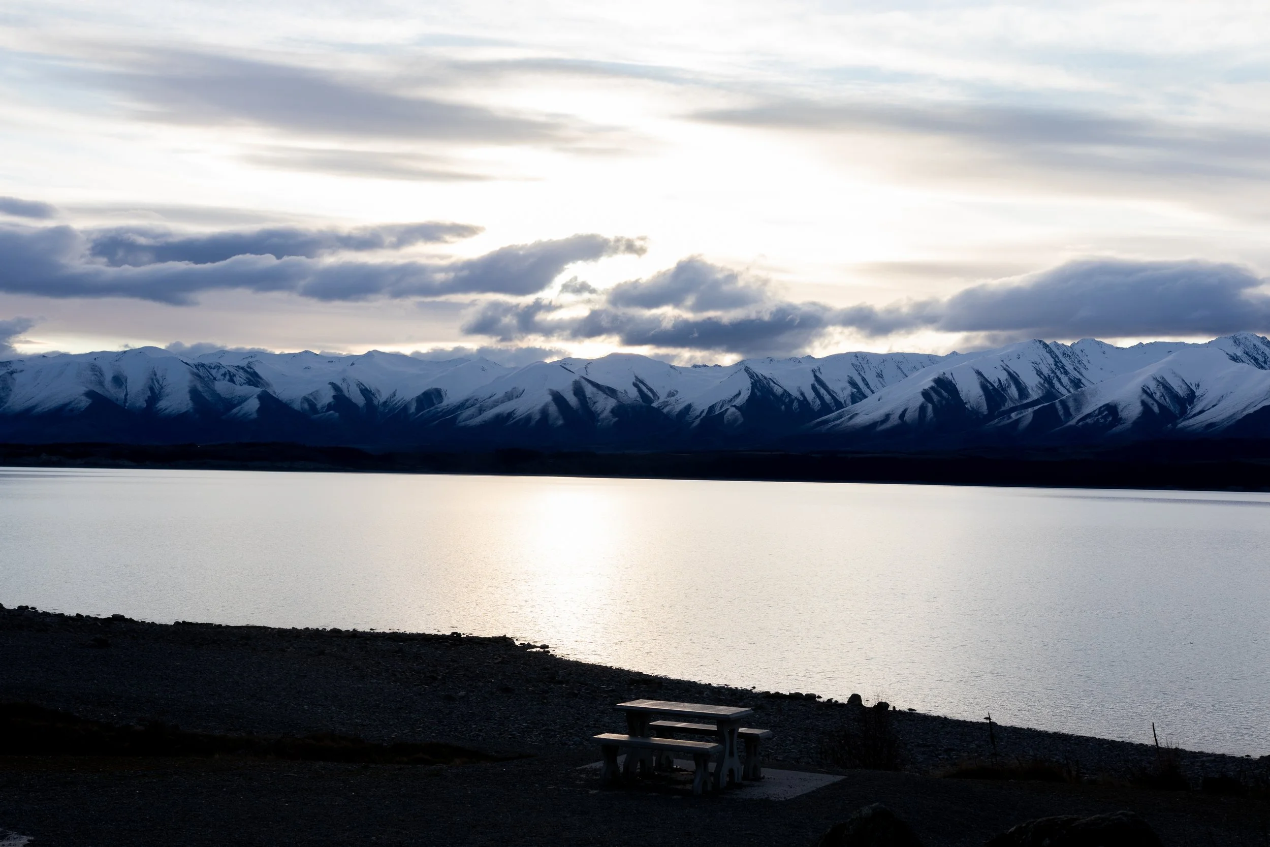
On the way to Aoraki / Mt. Cook.
Getting there
I lucked into getting a few weeks off between jobs and decided “what better time than now”. Did some brief planning - mostly just a few particular spots that I really wanted to see, bugged my mate Will for some hike recommendations (they call it “tramping” in NZ), booked the flights, a car and some of the stays to allow some flexibility. The flexibility would come in handy later as the weather in the South Island can be rather erratic - for instance, as I was checking the weather for Milford Sound a few days before arriving, it was showing that in excess of 100 mm of rain was expected most days. In the end, the weather was much better than I expected, but it still impacted my schedule somewhat.
As the 737 approached the destination, I was greeted by the somewhat spooky sight of snowy summits sticking out of the clouds here and there. I’m sure the pilots knew what they’re doing, but as an infrequent flyer, I think there’s a natural discomfort stemming from not seeing the clear path between the peaks. As we got closer to the lightly bumpy final approach to ZQN we left the clouds above and the beautiful mountain view became clear.
This was the first time I’ve ever travelled internationally with ADHD medication - I got diagnosed about 2 weeks before the trip. Since dexamfetamine is a controlled substance, I was a little paranoid about customs. I told the officer what I was carrying, got pulled aside, they inspected the bottle and the travel letter from my doctor. Didn’t give me any trouble other than causing a 5 minute delay. The return leg was even easier - Aussie border control officers didn’t even want to check my meds, just waved me through.
Upon landing, I was treated to an awfully long wait at the baggage claim. We were stuck for over an hour and got to begrudgingly watch people from the next flight get their luggage before us. This was not a busy time at the airport, mind you. Throughout the whole ordeal, there was only the one other flight. This had me worried whether I’d make it to the car rental place before it closes. Not off to the best of starts, but thankfully it worked out well - I made it in time.
As I was sitting on the floor of the crowded baggage claim, some officers walked through the area with a beagle. I thought they might be checking for drugs - so, in my paranoia, I prepared to explain the situation again, but it seems that the dog was only sniffing for food for biosecurity reasons. I think a food sniffing dog is, well, just a dog. Does that even require any training? I know for a fact that my old beagle Jantar would have found any food with ease and boy was he not well trained.
Queenstown

This view. Right in the middle of Queenstown.
Originally, the plan was to do the Ben Lomond hike - starting with a gondola ride - after landing and checking in. That plan went out the window pretty quickly - between the baggage delay and the weather, I decided it would be unwise to attempt it.
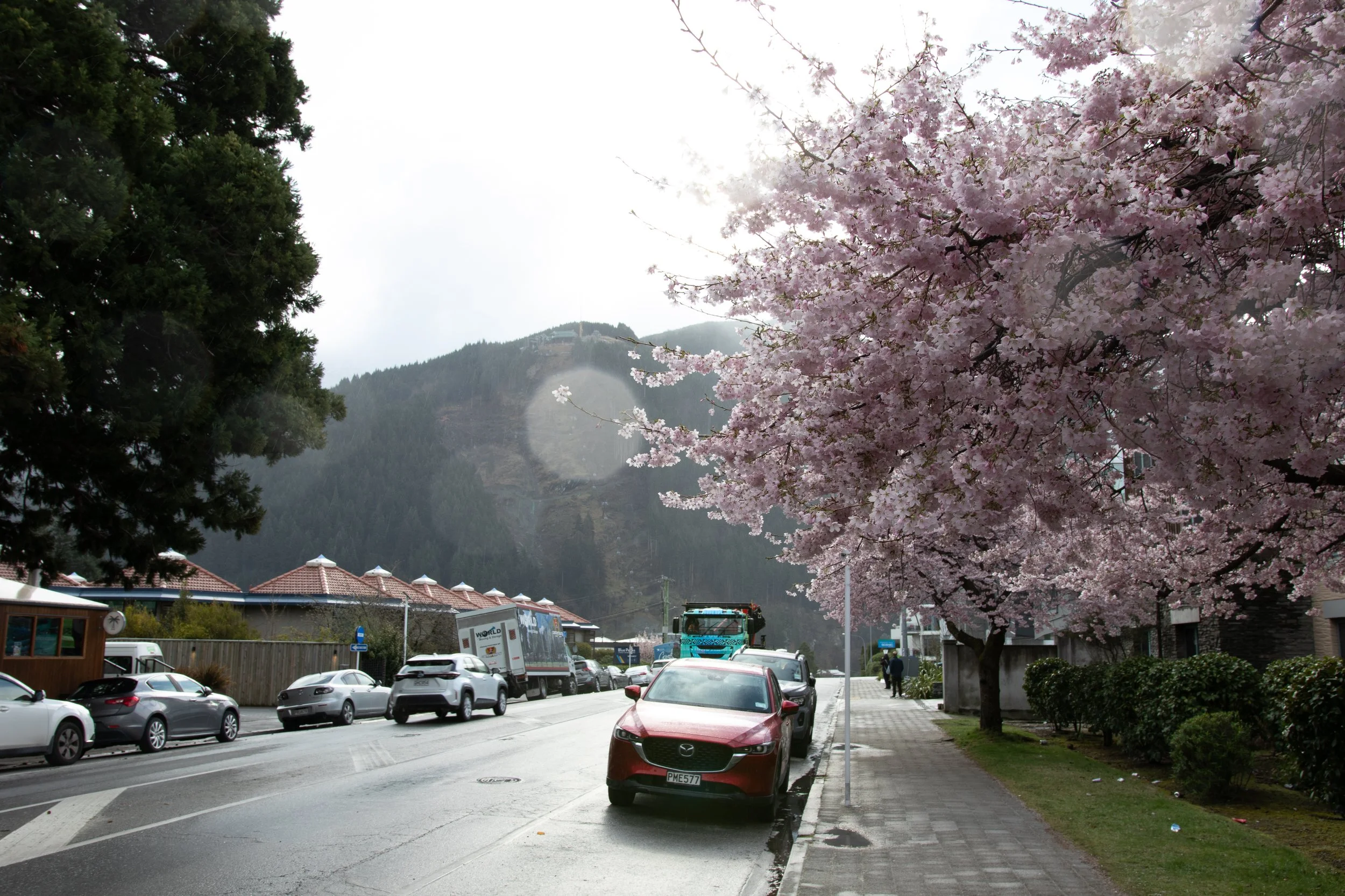
It was still winter up above, but down in the valley the spring was beginning to spring.
The weather in particular surprised me at first. Later in the evening there were some freezing cold showers, but even before then I felt much colder than expected. Thankfully, I would adapt to this cold very quickly - from day 2 on, it really wasn’t bad at all. Nice and fresh if anything. But that first taste of wintery air had me shivering.

The Remarkables. View from near the Skyline gondola, but they are also the first thing you notice when you get off the plane.
So I opted to only take the Skyline gondola and enjoy a local beer while watching Queenstown from above. The gondola ride is rather pricy - over the next few days I would saturate my eyes with even better views at a much lower cost. At the time, though, I definitely thought it was worth the fare.

The Remarkables again, from the top of the Skyline gondola this time.
Queenstown is a cute little town, if a bit too touristy for my taste - especially since it was still ski season. At approx. 28,000 residents, it was the biggest town I would visit during this trip. South Island isn’t particularly densely populated.

Down by the lake Wakatipu.
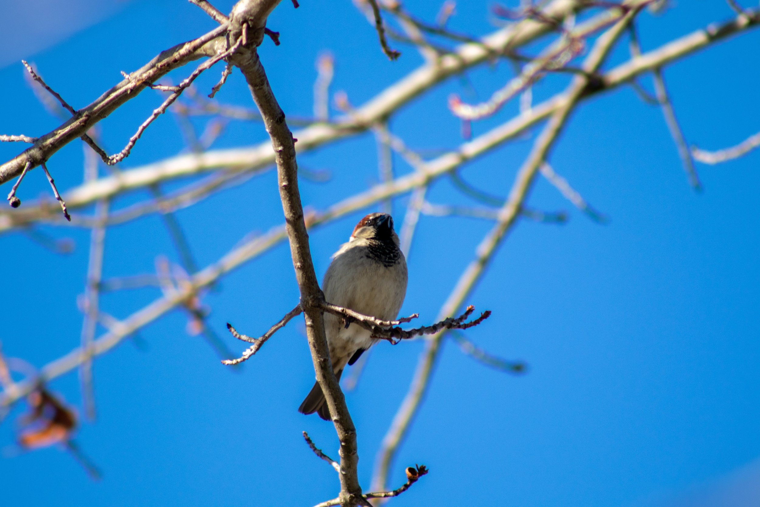
Queenstown is also home to a large population of sparrows, which always put a smile on my face, as well as chaffinches, blackbkirds and silvereyes. Blackbirds are also a very welcome sight - I used to see and hear them often in Poland and they’re very rare in Australia. I also got to see a wild tūī, which delighted me with its unique song.

Queenstown’s sparrows.
I had dinner at Farelli’s - good pizza, even better chocolate cake - and headed to my cabin accommodation in Arthur’s Point a little north of town. There, I discovered some car trouble - I found out the trunk lock is a bit dodgy. The little bottom hook required manual adjustment, otherwise it wouldn’t close, and it took me a surprising amount of fiddling by the flashlight to figure out how to get it to close.
I would soon also learn how cold it would be in the morning trying to get from the cabin to the shared bathroom as well as re-learn that frozen windscreens are a thing. I did not have a scraper - but thankfully a credit card did well enough in a pinch. I also decided I shouldn’t cheap out and get some actual fit for purpose hiking gear - went shopping in town and got some nice merino socks and a sweater. The sweater in particular was a very good purchase.
Waiting for the Kiwi Park to open, I went to grab a Fergburger for breakfast (and in the spirit of further flaunting the social conventions, I followed up with an 8:30 am beer at Ferg’s Bar). The burger was reasonably priced (or, rather, somewhat pricy but more than big enough to compensate), but it wasn’t as good as the hype had me believe. By no means bad though.
Once open, I headed to the Kiwi Park. I don’t exactly make it a secret that I’m a glutton for an aviary and this trip was no exception. This was the first place I got to see, albeit captive, kea, weka, kererū, kākā and 2 species of kākāriki. The former 3 I would later also get to see in the wild.

Kea are majestic…

… but also goofy.

And ultimately just big alpine chickens.

Sneak peak under the wing…

… where they hide some beautiful colours - as if the olive green wasn’t pretty enough!
Seeing kea for the first time was incredible. They’re bigger than I thought, their beaks look powerful and they’re the only species of alpine parrot in the world. They’re also very smart and very cheeky, which I’ll get to experience first hand later on in the trip.
I got to see a few kiwi as well, but pictures were not allowed and would be hard to take anyways due to their nocturnal enclosure. They truly are weird birds though. There are several species and I think they are the only bird family that has nostrils at the end of their beaks instead of at the top - and, unlike most birds, they actually do heavily rely on their sense of smell. They move surprisingly fast as they forage, digging through the muddy ground with their long beaks.
But in the end, Rick the kererū stole the Kiwi Park show. She is a rescue pigeon, half blind and a little worse for wear, but she is the roundest bird to have ever been round. I love her and wish I could take her home. In general, I really wish you could adopt a kererū. They’re perfect. Very pigeon, very big, very round, very green, very small head. The signs in their enclosure also said that they tend not to talk much, though they make a lot of noise as they crash through tree branches, but I did get to hear them coo twice while I was there.

This is Rick and I love her. The sheer beauty of her colours also makes this the only picture in this post where I consistently have to reduce either the size or the quality because the file tends to be too large.

Me and my best friend Rick.

Here you can see Rick’s bad eye. Poor girl has been through some tough times. But I’m glad she gets to live out her days at the park.

One of Rick’s buddies and a good showcase of how small their heads are.
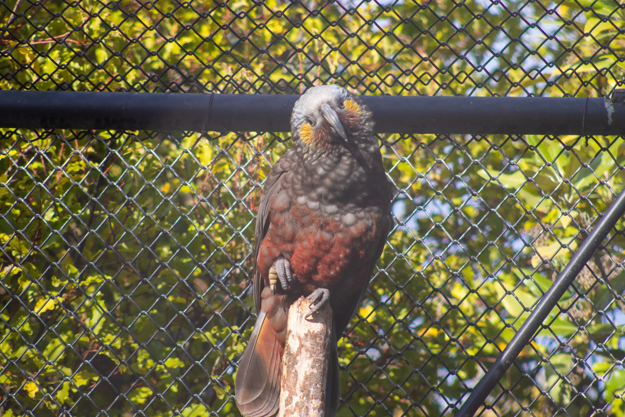
Kākā. They seem very playful. Unfortunately, their enclosure was not walk-in (a bit hazy - shot through the fence).

Kākāriki - yellow-crowned (a bit hazy - shot through the fence).

Kākāriki - red-crowned.
After checking out all of the birds, I went to Kiwi Park’s conservation show. In terms of spectacle, it was a little bit of a disappointment - expected to see more birds, but it was very interesting nonetheless.
The highlight was the tuatara, a non-lizard “lizard” endemic to New Zealand, whose conservation efforts have seen a lot of success. It looks like a lizard, but it isn’t one, and while closer related to lizards, it’s placed somewhere between them and birds. The person running the show told us that their lifespan is a little uncertain as “they keep outliving the researchers”, but it seems to be that at least over a hundred years is not uncommon.

And their eyes are amazing.
It was also interesting to find out that you can - and are in fact encouraged to - buy things made of possum fur. Possum, having been introduced, have been a disaster for the native wildlife. There’s a concerted effort to rid the island of them - and other introduced predators - by 2050.
Routeburn Track
Having seen what I wanted to see in Queenstown, I headed northwest through Glenorchy to the Routeburn Track. The route leads along the lake, offering more stunning mountain views, and later proceeds through pastoral land.
Routeburn - and the abundance of other ‘-burn’s in the area - made me wonder about the name. Turns out it means a large stream or a small river and originates from Scotland and North England. Same root applies to ‘-bourne’, apparently.

Bennett’s Bluff Lookout.

North of Glenorchy.

These guys will make some good sweaters.
Once at the track, due to limited time, I only hiked about 6 km out and then backtracked.

My head canon is that it’s a kiwi overgrown with moss.
Walking in the ever so slight drizzle I was in awe of the almost pulsating with life surroundings. I’ve never seen this much moss before - or lichen this lush. The whole area was incredibly moist, quiet and beautiful. This was the first time I saw the milky blue glacial waters and was absolutely taken aback. Later, of course, I would see that this shade of water is actually very common on South Island, but it wouldn’t exactly lose its magic.

My first close look at the glacial waters.

About as far as I got on the track.
The colour comes from “glacial flour” - a finely ground dust resulting from glaciers grinding against rocks.

Moss everywhere.
On the way back, I tried finding the Paradise sign. Unfortunately, I either missed it or didn’t get far enough. On the gravel road, I came across a rather ominous sign, warning of ford crossings and advising the road may not be safe for non-4WD vehicles - unfortunately, didn’t take a picture of the sign - and when I indeed came across a ford, I decided not to push my luck. Instead, I drove to Kingston at the far end of Lake Wakatipu for the night.
Another night, another cabin, another freezing rainy walk to the showers - but I did not care at all for the trip was already amazing.
Kingston
The original plan was to rush out and get to Milford Sound, but the road was closed due to avalanche hazard. Thankfully, I was able to reschedule my Milford Sound cruise at no extra cost, but that did mean I had to improvise for the day. I ended up booking a cruise to Te Anau Glowworm Caves.

Kingston siding.
I only explored Kingston briefly in the morning. Back in the day, to get to Queenstown, you would have to take a steam train to Kingston and then a steamboat across the lake. Today, with these newfangled aeroplanes and automobiles, both the train and the boat have become obsolete and defunct. Most of the rail line is disused, but, in season, you can take a trip on the Kingston Flyer on what remains of the line. It wasn’t the season. The little train station in town was converted to a pub, which I will revisit later.

But you can still have a peek at Mr. Flyer himself at his shed.
I headed to Te Anau. Along the way, I found the other terminus of what remains of the Kingston Branch line.

Fairlight station.
As everything else on the South Island, the road to Te Anau was quite picturesque - if more hilly than mountainous.

Somewhere between Mossburn and Te Anau.
Approaching Te Anau, I stopped by the Lions Point Lookout, but weather being what it was, the view wasn’t great. It kind of just became a wall of grey where it seemed like it would get interesting. I did get a few shots of the local farm animals though.

Mutton in the making.

Kiwis love their venison, it seems.
Having arrived at Te Anau, I found out my Glowworm Caves cruise got cancelled due to the weather. It had been raining quite hard all day. So I had to improvise further and decided to do the bottom part of the Kepler Track. I went to the local outdoor equipment shop and rented a pair of rain pants. Shout out to Outside Sports - they were very flexible in terms of returns, they offered that I can drop the pants off at the supermarket next door if I can’t make their hours. In the end, I managed to return them before they closed, but I really appreciated the flexibility.

At the beginning of Kepler Track.
Due to the relatively heavy rain, I decided to leave the camera in the cabin and thus I don’t have too much to remember the Kepler Track by. Phone got moist enough that it was kind of hard to use. But it was again very wet, very green and very lush. I walked about 4.5 km out, parts of the path flooded, until a huge fallen tree blocked my way. I couldn’t find a way around it so I headed back. This night’s cabins offered a complimentary sauna session which was very welcome after the rainy walk.
Milford Sound
The next morning I headed towards Piopiotahi - or Milford Sound. Having seen pictures before - as well as having been told about its beauty - I was really excited for what lied ahead. Spoiler alert: it absolutely lives up to the hype.

From the wharf in Milford Sound.
But I’m getting ahead of myself. Meanwhile, the road was still closed. The website said it’s expected to reopen at 11, so I started heading that way, hoping they will indeed reopen. It reopened… a bit past 12. I ended up being stuck waiting for it to open for about 90 minutes. But it was far from the worst place to be stuck - I secured a spot at Pop’s View Lookout before most of the crowd arrived. The views were stunning and I had a chat with one of the roadworks crew whose job was basically to be on the lookout for the aircraft that will drop the charges to clear the avalanche hazard. By no means the worst job in the world if you ask me.

Imagine getting paid to stare at this (Pop’s View Lookout).

What an awful job that’s gotta be (Pop’s View Lookout).

Out of captions (Pop’s View Lookout).
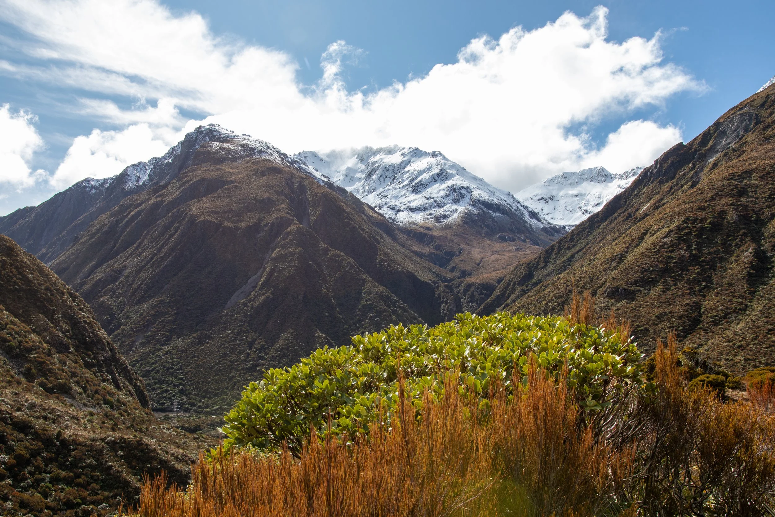
But I’m still getting ahead of myself. Before getting to this lookout, the road led through Eglinton Valley. The valley had something of an eerie feel to it - flat, dry grass bottom, misty forested hills to the sides - and further in, there was plenty of snow on either side of the road.

Mirror Lakes.

Eglinton Valley.
The whole road had a somewhat liminal feel to it. It went through several very different areas, culminating with Homer Tunnel, beyond which it became a whole new world. The tunnel, metaphorically and literally, marks a very clear transition point between “non-Milford” and “Milford”. Cutting through over a kilometre of rock, it also 20 years to dig - initially, with just a skeleton crew of 5 people. It leads down a steep gradient. Huge undertaking that I’m very glad they undertook.

Before the tunnel. Note the lichen.
After the tunnel (Hundred Falls).
The tunnel is also a popular spot for kea. Being the smart, cheeky buggers that they are, they enjoy interacting with the stopped traffic (traffic alternates through the narrow tunnel). I’m sure some people - sadly - feed them, but even apart from that, they love landing on cars and pecking at windscreen wipers. Technically, I took these pics on the way back… so I guess in a way I’m getting ahead of myself again.

(Birds excepted). Homer Tunnel, west end.

Got one in flight. Homer Tunnel, west end.

So cheeky. Homer Tunnel, west end. Hundred Falls in the background.
And then came time for Milford Sound. Technically, it’s not a sound but a fiord (false advertising) and, of course, very touristy - and I strongly dislike crowds. But it was absolutely worth dealing with the crowds and the pictures don’t do it justice.
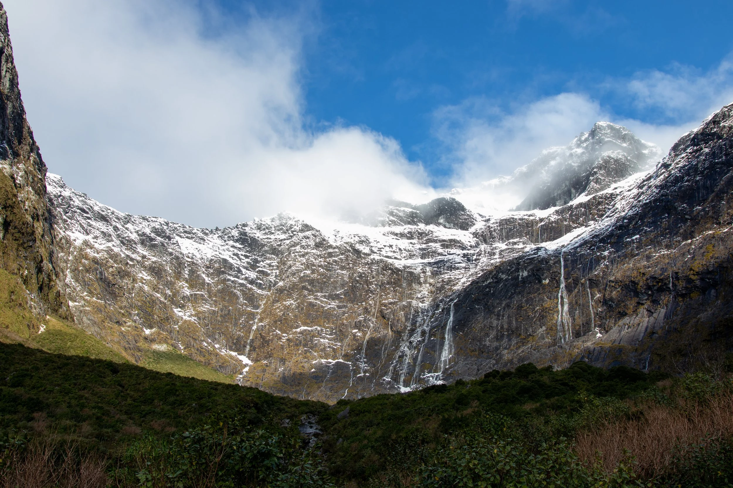
Milford Sound has 2 permanent waterfalls, one of which is used to power the village, and hundreds of temporary ones. Some of the temporary ones disappear within hours after the rain, some within days, but as the guide said - 10 days without rain in Milford is basically a drought. I was there soon enough after a heavy rain that many of the temporary waterfalls were still running.
Some of the cascades stretch more than 1500 metres tall.
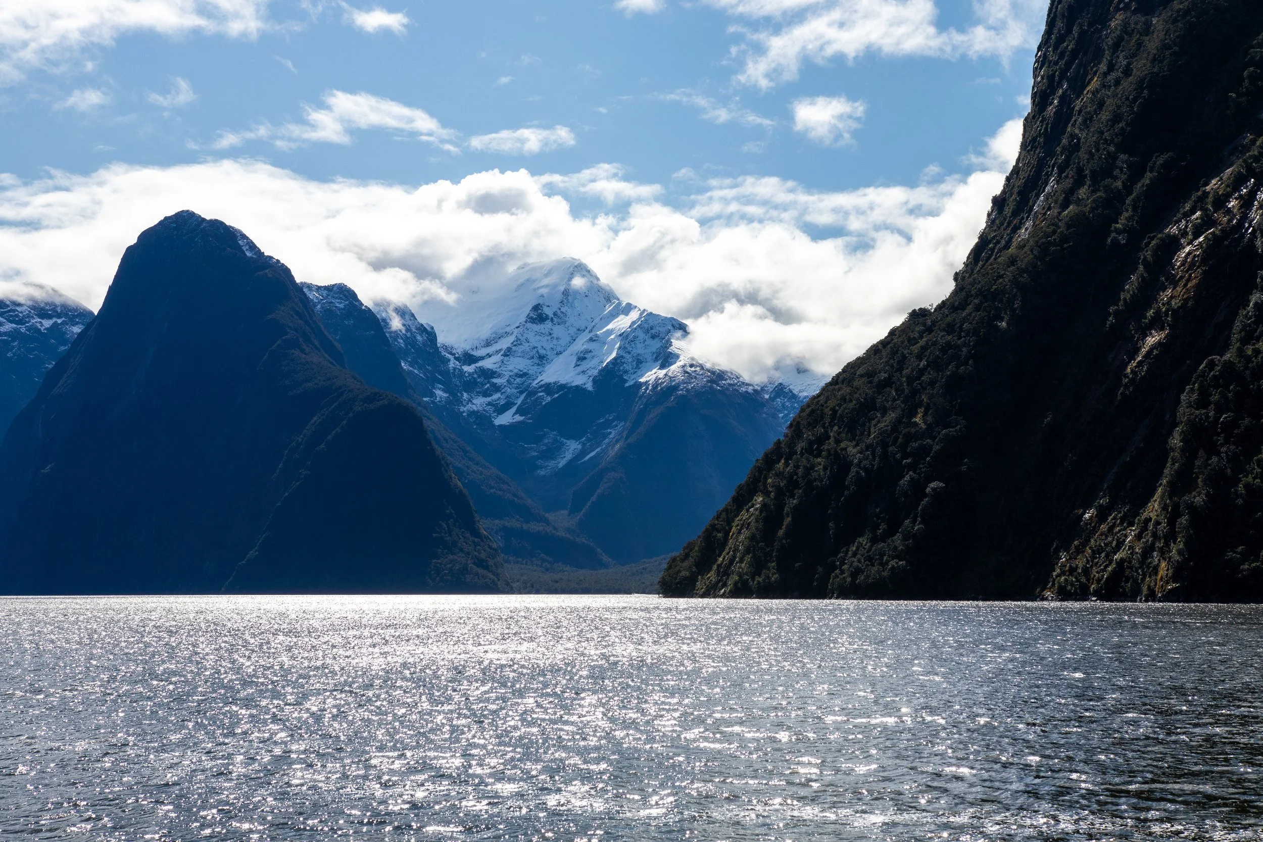
Milford Sound.

Milford Sound.

Milford Sound.

Milford Sound.

Milford Sound.

Milford Sound.

Milford Sound.

Milford Sound. Some of the smaller waterfalls just disappear into thin air.

Milford Sound.

Milford Sound. The permanent waterfall by the village. Wharf is around the corner to the right.

Milford Sound. Fiordland crested penguins. I failed to take a single sharp picture of them, despite literally 160 attempts - this is one of the best. Too much zoom and boat rocking.

Milford Sound. New Zealand fur seal.
On the way back, I stopped at Monkey Creek which is also a spot kea tend to frequent. And I met one that was more than happy to pose for a few shots. These were taken from very close - less than 1 metre - it wasn’t afraid of me at all and it climbed up on a little rock to give me a better backdrop.

Monkey Creek.

Monkey Creek.
As is customary for me, I tend to try to see as much as I can in a short time. This means that I had to get to Wānaka the same night. 95 km from Milford Sound as the crow flies… 343 km as the pavement-bound crow walks. Naturally, I got there quite late. As I went over Crown Range in the dark of the night I was worried about black ice - the car thermometer was showing 1 degree and there was snow around. Thankfully, no issues. Along the way, I stopped at Kingston - the same Kingston as before, and in fact in the aforementioned station pub - for some delicious cod and chips for dinner.
Wanaka
Seems like the heading font doesn’t like the bars over letters.
Wānaka has two main claims to fame, both of which I’ve visited - #ThatWanakaTree and Roy’s Peak. The former is a very easy, very short walk from a parking lot.
#ThatWanakaTree
The latter… oh boy.
Roy’s Peak
Will was my primary resource for hikes on this trip. He is also an absolute hiking and trail running machine. This means that he knows where the views are, but he can also overestimate other people’s capability. I’m in a decent cardiovascular shape from all my cycling, but I’m still heavy and my legs aren’t used to hiking.

Not far up at all and I’m already drenched in sweat.
I made it to the top. I made it back down. I could barely walk up - and especially down - a kerb for the next 3 days. My legs have never been this sore. At the bottom of the descent they were literally violently shaking just trying to stand. Ouch oof.
Worth it.

A little higher into the snow.
The trail to the peak is easy - or should I say ‘simple’ - in the technical sense - it’s well maintained, not very rocky, no slippery roots to watch out for. But it’s very steep - over 1300 vert metres over approx. 7.5 km - and unrelenting - it basically never flattens out. The beginning is particularly steep. I started off with a fairly fast pace - the same pacing issue I often have cycling, I go harder than I should - and about 500 metres in, I was ready to give up. I managed to fall into a more steady rhythm though.
On the way up, it started off as a dry path through pastoral land, then got somewhat muddy. Then, as I got high enough for it to be snowy, I also walked into the clouds. This had me worried I won’t be able to enjoy the views at the top, but at this point I was committed to getting there regardless. Thankfully, the cloud layer didn’t reach all the way to the top and the views were mesmerising.

Working my way up through the clouds.
About halfway to the top, I caught up to two Estonian lads on a working holiday, Allan and Kaido. The chats helped take the attention away from the effort. I also learned how to say “twelve months” in Estonian (kaksteist kuud, hehe - if you don’t get it, you can find the pronunciation online). Once we got to the top, it suddenly turned out that it’s actually cold (on the way up, I was overheating and quite literally steaming), so we slapped on some extra layers and enjoyed the view.
This view.
Long way back to the parking lot.

Proud of this shot. I think it’s a song thrush. At the summit.
At the top we also met Bee, an Aussie girl on holidays in NZ, and she accompanied us on the way down. She was able to leverage her ski pants to slide down the steeper snowy bits.

From the front: Kaido, Allan and Bee.

Love this shot of Kaido too.
Speaking of interesting hiking choices, how Kaido kept his toes after sloshing down the snow slush in his badminton shoes is beyond me.

Lower lookout.

As we went down, the shadows got deeper.

Almost back down.
Once back at the parking lot, Bee split off, while myself and the boys went for dinner in Wānaka at The Cow. Huge garlic bread. Like, a literal loaf. Afterwards, I headed to Franz Josef. Another long drive in the dark with hardly any cars at all and possums galore.
Westland
The plan was to do the Franz Josef Glacier hike - but of course my legs didn’t work after Roy’s Peak. So I stuck to the easy stuff. For starters, drove to a lookout with a view of Fox Glacier. There, I finally saw some wild kererū.

Fox Glacier.

Kererū taking in the Fox Glacier view.

Preening.
The next stop was Hokitika Gorge. Bee recommended checking it out and while I initially had other priorities, I decided this will be a less intense alternative to Franz Josef. The hike was short and flat, but it still took a lot out of my legs as I walked very slowly. Apart from the gorgeous (hehe, get it?) blue water, I spotted a fantail, a South Island robin and a weka. The fantail in particular was very playful, repeatedly flying very close past me and other visitors.

Hokitika Gorge.

Weka at the Hokitiga Gorge parking lot. Cheeky food stealing buggers. Back at Kiwi Park we were treated to a presentation of how they dig through backpacks.

Fantail at Hokitika Gorge. I choose to see them as New Zealand’s answer to Australia’s willie wagtail - two birds with a similarly frowned brow.

South Island robin at Hokitika Gorge.
This nights stay was at Arthur’s Pass. At the time, there were road closures due to a landslide at Otira Gorge Rock Shelter. On weekdays, the road would only open once every hour to let the traffic through and would be closed altogether at night. Thankfully, I was driving through on the weekend, so didn’t need to worry about the delay.
On the way to Arthur’s Pass I finally got to snap a few pics with the drone I brought with me. New Zealand is quite restrictive with where it is and isn’t legal to fly drones. I’m not entirely sure if all of my flights were fully legal, though I did make an effort to not fly where I knew it wasn’t allowed. Between restrictions and weather, I didn’t get to use it much.

Otira River.

Otira River.

Otira River.

Otira Viaduct.
Otira Valley
In the morning I had a chat with the lady taking care of the accommodation. She seemed quite the character. Hailing from Mississippi, she’s was a biblical archeologist, having dug in Israel and also served in the US military, then moved to Australia and at the time was doing volunteer work in NZ. Her name escapes me now, but I remember thinking she was very young at heart, if a little eccentric.
With legs still out of commission, the Avalanche Peak hike I had hoped to do at Arthur’s Pass was a no go. Instead, I backtracked slightly and did a small part of the Otira Valley Track. While not very steep, it was still a major ordeal for my wrecked legs - especially any small bit of downhill.
Otira Valley Track.

Otira Valley Track.
The drive to Twizel
I spent most of the rest of the day just driving. I needed to get to Twizel for the night. The main two points of my interest along the way were Rakaia Gorge and Lake Tekapo, but the highway down from Arthur’s pass also proved very scenic. I also drove through the small town of Methven, which, despite its name, proved quite charming.

Somewhere along Great Alpine Highway.

Somewhere along Great Alpine Highway.

Lake Lyndon.

Porters Pass (I believe this is technically a selfie).
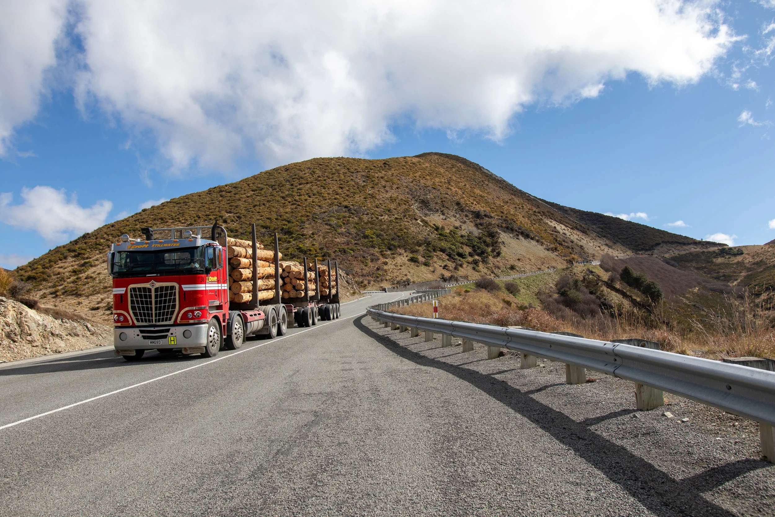
Logging truck going down Porters Pass.
Rakaia Gorge.

Rakaia Gorge.
Lake Tekapo.
Lake Tekapo is a renowned dark sky area, but unfortunately time (and rather cloudy skies) did not permit a proper star gazing. Definitely something to return to!
Upon arriving in Twizel, I managed to find a food truck serving some woodfired pizza and went to the lodge to crash.
Aoraki
I remember the night at the lodge being very cosy. It was close to freezing outside, I had the window slightly open, so it was hard to get out from under the sheets in the morning. Plus the sound of the chirping sparrows outside! The accommodation itself was somewhat dated, but definitely good enough for my needs - and far cheaper than what was available at Mount Cook Village.
Sparrow near the bakery.
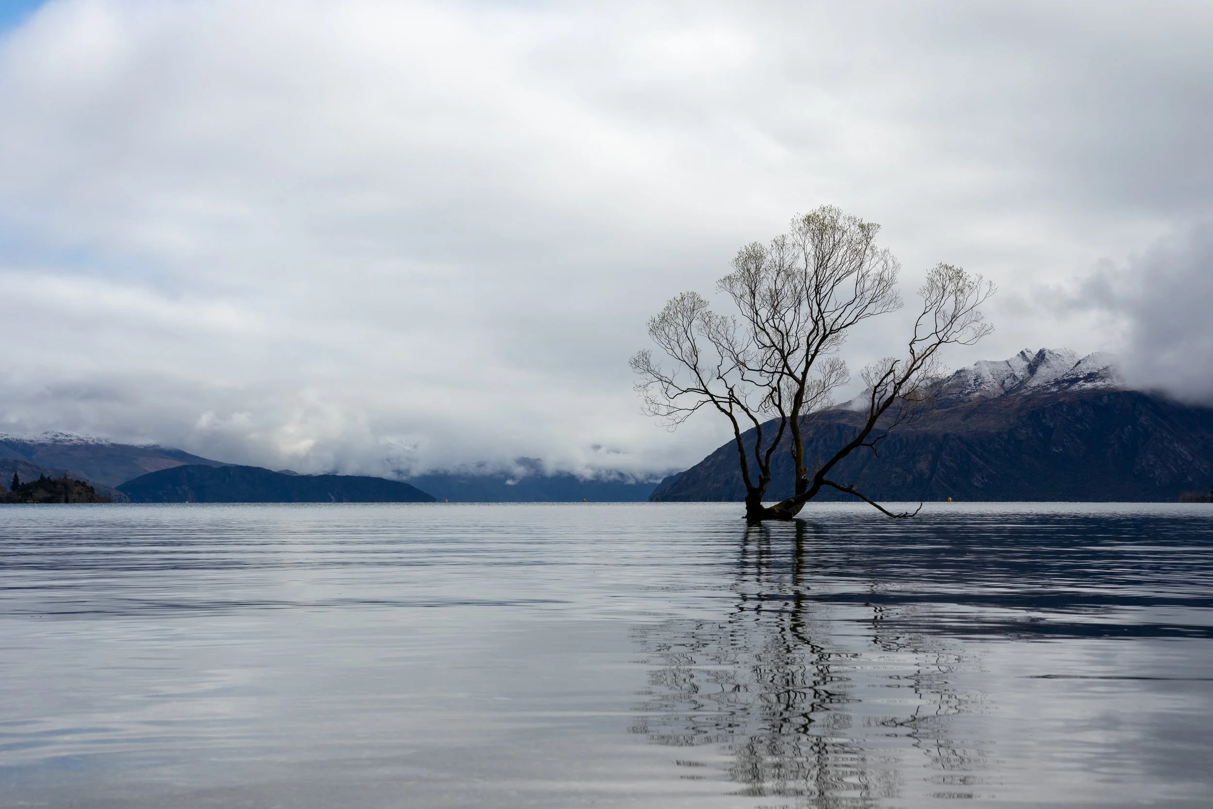
I grabbed some sausage rolls at a local bakery and headed to the Hooker Valley walk. It’s about an hour’s drive from Twizel and the entire length of it is breathtaking - that’s where the opening picture comes from. Mountains, lakes, snow. Extremely fresh air. By this point my legs were starting to work again - and the Hooker Valley hike itself is easy.

Morning frost on the railing at Lake Pukaki Lookout.

Mount Cook Road.
Hooker Valley turned out to be an absolute winter wonderland. Fresh snow, icy cold mountain rivers, views of glaciers and, at the end, a view of South Islands tallest mountain, Aoraki, over Hooker Lake. At over 3700 meters above sea level, it’s the tallest mountain I’ve ever seen in person. I’m really glad I got to see it in the winter, though I’m sure it’s also beautiful when more of the snow is melted.
The walk is an ever so slight incline, but the biggest danger is slipping on the snow or slush as the snow melts during the day, especially in the few spots that have some steps. On the way back, the weather took a bit of a turn for the worse - it started drizzling a bit and the wind picked up, but nothing too troublesome. I did feel for some of the people doing the walk who seemed a little underdressed though.
On the way back I was accompanied by an Austrian guy on a 6-week holiday in New Zealand, having done several multi-day hikes before arriving at Hooker Valley. We had a nice chat heading back to the car park. He then went on towards Mueller Hut, though I don’t know how far he made it. Unfortunately, his name escapes me.

This guy is gonna wake up to quite the view.

Aoraki.

River flowing from Hooker Lake to Mueller Lake (Google Maps does not list this river’s name - maybe it’s just too short).

Same river, different spot.

Fresh snow in the morning.

Weather change on the way back.
After the hike, I headed to Queenstown for the final night before flying back to Sydney.
Some final thoughts
Aotearoa is the te reo Māori word for New Zealand. Te Waipounamu is the name for the South Island. Apparently, the latter isn’t a very commonly used name, even among the Māori. Oh well! There’s something about te reo Māori that I find very appealing. Maybe it’s the amount of vowels. Maybe it’s the limited variety of consonants. Maybe it’s the fact that the most common way for anyone outside of Aotearoa to hear it is watching an All Blacks pre-game haka. Either way, the language just sounds awesome (in both the proper and common meanings of the word).
New Zealand - or at least the part I’ve seen, which isn’t even all of the South Island - is an absolutely stunning place. The way I described it to someone back home during the trip was that if you grabbed a random person, gave them a camera, airdropped them into a random spot on Te Waipounamu and pointed them in a random direction, they’d be more likely than not to take a postcard worthy picture. I will definitely be returning to explore more. The sheer density of natural beauty is completely off the charts. There probably are some places in the world that can compete, but I haven’t been to any of them.
It also stood out to me just how clean the place was. Living in a large city, unfortunately, there’s a lot of garbage floating around. Way too many people who just don’t care - and even then, Sydney is far from the dirtiest in the world. But I can’t recall seeing any garbage anywhere in the South Island. Maybe it’s just the small population caring more about their neighbourhoods. Maybe it’s local councils taking care of it to ensure tourists want to go there. But it amazed me nonetheless.
Drivers also seemed much more corteous. The roads are winding and narrow and can be bumpy, but it seems like a fair amount of people actually do use the little bays to let others overtake. Less ego, more wanting to get everyone safely and conveniently to where they’re going. I don’t think I’ve ever seen a regular car in Australia - going 20 under - use the slow vehicle bay to let someone pass. I’ve seen plenty in NZ. Though their “everything is a zone” approach to speed limits is a little weird at first.
Due to how mountainous the area is, there are many cases where there is no “direct route”. An extreme example is Fox Glacier to Mount Cook Village. Straight line distance is just 30 km - the shortest road is 455 km. It’s not exactly an insurmountable obstacle by any means, but it does require thinking a little differently about getting places.